Tag Archives: Google

Batch Geonews: GeoPublisher and AtlasStyler 1.9, Ten Things about GPS, MapInfo Pro 11.5, and some more

Here's the recent geonews in batch mode.

From the open source front:

  • Along with new versions, here's the Geopublisher and AtlasStyler 1.9 release notes

From the Google front:

  • Slashdot discusses a story named After Modifications, Google Street View Approved For Switzerland
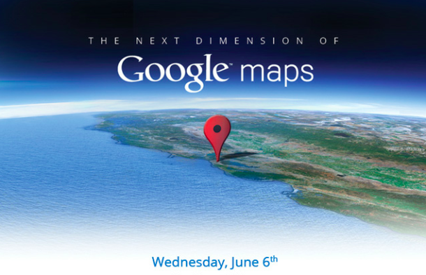
  • There was an imagery update on June 11th

Directions Mag articles:

  • An article named My Top 6 Takeaways from SQL Server Spatial
  • Another one named Ten Things You Need to Know About GPS, reminding us that often people use the GPS term while they really should use GNSS
  • Another one named Intergraph’s GIS Product Roadmap Comes Into Focus
  • And for Pitney Bowes, New Features for MapInfo Professional Version 11.5, and by the way, Facebook Is Using Pitney Bowes Software for Geocoding

In the miscellaneous category:

  • MacRumors summarizes the U.S. Location Privacy Protection Act
  • MapQuest released an all new MapQuest for iPhone app
  • Rumors that Microsoft is Going 100% with Nokia Mapping in Windows Phone 8
  • After Google, Microsoft jumps in the Augmented Reality future with rumored AR glasses for Xbox
  • Slashdot discussed a story named 64 Drone Bases Located On American Soil

In the maps category:

  • O'Reilly shared a map of global BitTorrent usage
Read More »

Batch Geonews: GeoExplorer, Google vs Apple Maps, Unmanned Aerial Systems, London Olympics, Tornadoes, and more

Here's the recent geonews in batch mode.

From the open source front:

  • OpenGeo runs an entry named Five things you didn’t know about GeoExplorer

From the major companies front:

  • I liked the Google vs Apple mapping discussion from Peter Batty: "Google announces that it is scared of Apple Maps
    [...] Now don't get me wrong, Google is the market leader and Apple has everything to prove."
    See also his entry named Apple Maps: Predictions and Questions, which are also of course innovations Google could implement. Viva competition! (well ok, I admit I prefer cooperation ;-)
  • James has an interesting entry named One Man's Disruptor is Another Man's Incumbent, the incumbents are Google Maps, MapQuest, Esri and Microsoft, and the disruptors are MapBox, Esri and Apple
  • Via O'Reilly, the connection between Google Street View and driverless cars: "Now, I’m realizing the biggest Street View data coup of all: those vehicles are gathering the ultimate training set for driverless cars." Read the comments, driverless cars data is not simple
  • There's 2 new modules for Bing Maps V7: GeoJSON and WKT reader/writer modules
  • The GEB discusses Using StreetView to validate 3D models

Discussed over Slashdot:

  • NASA Tool Shows Where Forest Is Being Cut Down
  • Autralian Mining Companies Increasing Use of UAVs
  • Cognitive Software Identifies America's Brainiest Cities
  • John Carmack Is Building a Virtual Reality Headset
  • Trained Rats Map Minefields With GPS

In the everything-else category:

  • The eoPortal shares an entry named US not losing its foothold in Earth observing satellites, only shifting power
  • The eoPortal also mentions a new imaging system produces 3D models of monuments using unmanned aircraft
  • On that very topic, DM shares an article named Ten Things You Should Know About Unmanned Aerial Systems (UAS)
  • VerySpatial have an informative entry on geospatial at the upcoming London Summer Olympics and U.K. in general
  • AR as entertainment of the future? Kinect and RFID power an augmented reality theme park (via OR)

In the maps category:

  • Here's a nice visualization of 56 years of tornadoes in the U.S.

As a bonus for reading till the end, here's a interesting quote: "If a picture is worth a thousand words, a map can be worth a thousand spreadsheets."

Read More »

Google Announces Much Improved 3D Models for Google Earth, Offline Maps for Android, 12 New Map Maker Countries, and more

Today Google announced a few major upcoming features to their map-related products, including much improved 3D models for Google Earth and offline maps for Android.

From APB and the official Google blog :

  • On the 3D models: "today we are excited to announce that we will begin adding 3D models to entire metropolitan areas to Google Earth on mobile devices." [...] "[...] advanced automated 3D model creation from imagery. He noted it’s not new, but it far better than what came before. It uses stereo photogrammetry from many well overlapping images. [...] Google is contracting planes to collect the imagery." [...] "By the end of the year we aim to have 3D coverage for metropolitan areas with a combined population of 300 million people."
  • On Android offline maps: "So today we’re announcing that offline Google Maps for Android are coming in the next few weeks. Users will be able to take maps offline from more than 100 countries. This means that the next time you are on the subway, or don’t have a data connection, you can still use our maps."
  • They also announced Street View Trekker: "There’s a whole wilderness out there that is only accessible by foot. Trekker solves that problem by enabling us to photograph beautiful places such as the Grand Canyon so anyone can explore them. All the equipment fits in this one backpack [...]"
  • Map Maker is coming to several new countries (too bad for my hopes of seeing Google move to OpenStreetMap data ;-): "Today we’re announcing the expansion of Map Maker to South Africa and Egypt, and to 10 more countries in the next few weeks: Australia, Austria, Belgium, Denmark, Finland, Liechtenstein, Luxembourg, New Zealand, Norway and Switzerland."

If you want to see screenshots of the event, CNET has plenty of them.


Read More »

Google Geonews: Google+ Local Launched, Transit of Venus in Google Earth, Google Glasses Demo, and much more

Before tomorrow's event, here's the recent Google-related geonews.

From official sources:

  • Google launched Google+ Local, "a simple way to discover and share local information featuring Zagat scores and recommendations from people you trust in Google+"
  • There's New 45° imagery available for 26 cities:
    • US: Albany, GA (outskirts); Atascocita, TX; Clarksville, TN; Columbia, MO; Corpus Christi, TX; Fayetteville, NC; Fort Collins, CO; Fort Smith, AR; Greensboro, NC; Jackson, TN; Lafayette, LA; Plaquemine, LA; Pueblo, CO; Santa Fe, NM; Texarkana, AR; Tyler, TX
    • International: Bern, Switzerland; Cracow, Poland; Dublin, Ireland; Gdansk, Poland; Lugo, Spain; Ourense, Spain; Poznan, Poland; Warsaw, Poland; Wroclaw, Poland; Zurich, Switzerland
  • You can now Explore historic sites with the World Wonders Project
  • There's now Street View data over the Indianapolis Motor Speedway
  • And if you're in Europe instead, Explore the football stadiums of Poland and Ukraine as they prepare to host the European Championships
  • If you're a fan of bridges in the U.S., check out this entry named Band of Bridges: Celebrating the Golden Gate Anniversary

From other sources:

  • Here's tonight's Transit of Venus in Google Earth
  • Nate Irwin shares an entry named Google imposing more restrictions on Google Maps API, and since he mentions "For example, you are not permitted to: (i) use or provide any part of the Service or Content (such as map imagery, geocoding, directions, places, or terrain data) in an API that you offer to others", I wonder what it means for OpenLayers and other similar tools?
  • Here's a SearchEngineLand article named Google Places Is Over, Company Makes Google+ The Center Of Gravity For Local Search
  • You will see mostly talk and no actual demo, but here's Sergey Brin Demos Google Glasses Prototype
  • The GEB shares an entry named How Google Earth is being used by the Philippine National Police
  • Another rumors going in the same direction, Apple Replacing Google Maps On iOS With Its Own Solution Later This Year
  • The GEB shares the incredible 3D buildings of Istanbul, Turkey
  • And of course, there was new imagery too
Read More »

More creative Maps

ANDREW ZOLNAI BLOG "turning stats into maps" update: I ran across these interesting web-mapping innovations:

- incredible detail helsp contrast cross-Europe travel taday vs, Roman times
- web data creation are contrasted for citizen weather stations and celestial measurements
   (as well as contrasting celestial measurements across 250 years time span)
- with Jubilee events in England a beautiful map of one of the many events under way 
 
Read More »

The Next Dimension of Google Maps Event Announced for June 6th

While we'll know in a few days what this presumably big announcement in terms of upcoming features is all about, Google sent an invitation to 'The Next Dimension of Google Maps' event that will be hosted next Wednesday. In addition to CNET, I saw it featured on Slashdot and MacRumors.

From the invitation: "At this invitation-only press gathering, Brian McClendon, VP of Google Maps and Google Earth, will give you a behind-the-scenes look at Google Maps and share our vision. We'll also demo some of the newest technology and provide a sneak peek at upcoming features that will help people get where they want to go -- both physically and virtually. We hope to see you there."

I like MacRumors' analysis: "The timing of Google's event naturally leads to speculation that it has been specifically planned to upstage any Apple announcement about mapping in iOS 6 and to show what users will be missing out on with the transition by Apple."

Read More »

Is Google Maps GIS Lite?

WebMapSolutions shares an interesting entry named Is Google Maps GIS Lite?

From their conclusion: "When compared to the expensive, but well-polished products of ESRI, they may seem a bit rough in some areas, but they are also considerably cheaper or free to use as well. Everything is a trade-off. The hardcore GIS capabilities are not up to the same level as others such as GeoServer or ESRI, but then again that’s not what Google is shooting for either. They seem to be happy helping to expand the lighter, much larger-scoped public side of geospatial (which do cover a lot of use-case scenarios). [...] The direction is not towards traditional GIS work, but more into expanding the geospatial capability and usability on mobile devices. [...] Google kicked the old GIS world in the pants in. They have plenty of expertise and money on their side to do it again."

Read More »

Google Geonews: Indoor Directions for Android, Spreadsheet Mapper 3, Google Earth Builder Renamed Google Maps Engine, and much more

Catching up geonews, here's the recent Google-related geonews.

From official sources:

  • The latest Google Maps 6.7 for Android introduces Google Offers and Indoor walking directions
  • We mentioned Speadsheet Mapper in, and now Spreadsheet Mapper 3 is available, in short, "Spreadsheet Mapper is a tool that enables anyone to easily create a well-designed  KML file  to show off their data in Google Earth and Maps"
  • The Baltic nations of Estonia and Latvia are now in Street View
  • Here's the 'Model your Town' winner, Getaria, Spain
  • In Google Maps, 'work' and 'home' made their way to My Places
  • Regarding Google Earth Builder that was renamed Google Maps Engine, nonprofits can have it for free
  • Here's the latest improvements of the Google Places API searches
  • And of course there was an imagery update on May 14th, and on May 4th too

From other sources:

  • Slashdot mentioned Google Gets Driverless License For Nevada Roads
  • At the beginning of the month, the GEB showed the One World Trade Center building model in Google Earth, and later, Saint Basil's Cathedral
  • Using Google's Fusion Table on mobile devices? Look at My Fusion Tables
  • Slashdot discussed a story named Google Releases Key Part of Street View Pipeline
Read More »

Google Geonews: Google Maps Cube Game Unleashes, Photo Tours in Google Maps Announced, New 45° Imagery, and much more

Some pretty interesting Google geonews in batch mode.

From official sources:

  • Google announced Photo tours in Google Maps: "Photo tours are available for more than 15,000 popular sites around the world [...] To produce these photo tours, we use advanced computer vision techniques to create a 3D experience from public, user-contributed Picasa and Panaromio photos."
  • The new 3D buildings announced last month are now available in Google MapsGL
  • There's new 45° imagery available for 19 cities, International: Avignon, France; Reus, Spain; Rotterdam, Netherlands; L'Alcudia, Spain; Gandia, Spain; Sueca, Spain; Burgos, Spain; Los Palacios Y Villafranca, Spain, US: Albany, GA; Omaha, NE; Baytown, TX; Miami, FL; Amarillo, TX; Monroe, LA; Manchester, NH; Alexandria, LA; Rapid City, SD; Loudon, TN; Farmington, NM
  • Street View is now available in Ukraine

From other sources:

  • It's James that made me aware that the Google Maps game 'Maps Cube' is available, I couldn't test it yet on the Linux machine in front of me. Here's how James describes it: "Basically you use your mouse to tilt a 3D cube and have a ball travel down the transportation networks (road, trails, subways, etc). Since we in GIS all know about topology in these networks, the game isn’t as hard as you might expect. Still it’s a pretty amazing example of using HTML + WebGL for web mapping." APB also links to a short PC Mag article on the Maps Cube Game.
  • The GEB shares an update on the impressive Data Appeal visualization tool for Google Earth
  • Slashdot also ran the story named Google Releases FCC Report On Street View Probe
  • If you want analysis of Trimble's acquisition of SketchUp from Google, read more from the GEB, from Spatial Sustain,
  • Here's Plymouth, Michigan in 3D
  • And to end with something funny, here's UFO Sightings in Google Earth

Read More »

Trimble To Acquire Google SketchUp

This comes as a surprise to many, Slashdot discusses Trimble To Acquire Google SketchUp.

Their summary: "It looks like Google is selling off SketchUp or, conversely, Trimble is acquiring it. Despite several indications there will continue to be a free version of the 3D modelling software, users are unsure about what this will mean for the SketchUp community at large as indicated by the comments on the official Google SketchUp Blog post. They are, however, rejoicing that they will be freed from Groups for SketchUp discussions."

From the Trimble press release: "[...] we are committed to continuing to provide SketchUp as a free version to millions of users."

We of course mentioned tons of times SketchUp, which is a popular tool to generate 3D models. Trimble also found the road to our users quite a few times.

Read More »