Satri

Winners of the ArcGIS Book Contest

Packt Publishing and Slashgeo are happy to announce the 10 winners of the 'Give Away Contest - Grab a chance to win a free ArcGIS Book eCopy!'. Winners were chosen amongst participants over Slashgeo, and the GIS and ArcGIS Server groups on LinkedIn. Congratulations to winners!

The prizes were a free digital copy of "Building Web and Mobile ArcGIS Server Applications with JavaScript"  written by Eric Pimpler.

Read More »

Batch Geonews: Municipal Datasets, 3DEP - 3D Elevation Program, more Transit in Google Maps, and much more

Here's the recent geonews in batch mode.

From the open source and open data front:

  • Rezoning permits are #1, Open Data Summit Top 10 Most Wanted Municipal Datasets
  • New open source tool, batyr: On-demand synchronization of vector data to a PostGIS database
  • QGIS improvements the QGIS Field calculator is dead. Long live the Field calculator bar
  • Something many end up doing, and here's a guide to do it, A guide to the rasterization of vector coverages in PostGIS
  • An extension in development to make OpenLayers more powerful, CAD-like Feature Construction with the OpenLayers Editor
  • Open data is everywhere, and any time! OpenHistoricalMap is a project designed to store and display map data throughout the history of the world
  • GeoAwesome asks Should navigation companies move to OpenStreetMap like Telenav?
  • Is a new website newsworthy? The new GeoServer website is certainly a nice improvement
  • Getting closer to version 1.0, here's another summary of GeoGit - Distributed geospatial data versioning based on Git
  • Geoff also shares a summary on the state of Canada's open geospatial data initiative
  • On the American side, the NED DEM dataset will be replaced by 3DEP - 3D Elevation Program, offering always higher spatial resolution

From the Google front:

  • Google provides an update on transit directions in Google Maps, including all transit routes in Great Britain and host cities in Brazil, real-time updates for Vancouver and Chicago, and more, also mentioning that transit is available in "64 countries and more than 15,000 towns and cities worldwide"
  • At the beginning of the month, new Google Map apps added several new features, including Uber integration and an offline button for iOS
  • The GEB shares Tips to make Google Earth appear more realistic and the screenshot is convincing and here's How the Google Earth cache works
  • If you don't already know what those geometric structures are on the sea floor, Did Google Earth discover an underwater alien base?
  • Want to understand El Nino? Everything about the El Nino Zone in Google Earth
  • We told you about Project Tango already, Slashdot discusses Google Rumored To Be Making 3D-Scanning Tablets
  • One article I missed published last month, in forestry, Google Earth Engine Brings Big Data to Environmental Activism
  • And yes, here's the list of locations for this month's new Google Earth imagery

In the everything-else category:

  • GeoJSON now an official media type registered with the IANA (IANA on Wikipedia)
  • Over the Spatial Law site, an entry named White House Big Data and Privacy Report: Wake Up Call for Geospatial Community?
  • At the research stage, ‘Quantum Compass’: Navigation technology that might replace GPS, this is also discussed over Slashdot
  • Numbers to say it's worth, contribution of Geospatial Industry to Irish Economy in: E69.3m
  • Interesting to see what is considered the Big 5 of geospatial: future cities, open geospatial, BIM, big data and policy, it's a series of events planned for next Fall
  • Another free online course, Simon Fraser Professor Introduces GIS MOOC
  • A short reminder of the potential of Augmented Reality and Geospatial Technology
  • It's happening, Volvo Testing Autonomous Cars On Public Roads
  • Privacy, US Police Departments Using Car Tracking Database Sworn To Secrecy
  • But there's useful uses to tracking? Robbery Suspect Tracked By GPS and Killed
  • Creating 'Swarm', Foursquare Splits To Take On Yelp
  • Deeply into remote sensing? A new eNewsletter from the IEEE Geoscience and Remote Sensing Society
  • The Proba-V mini-satellite, Views of Earth From Europe’s New Plant-Mapping Minisatellite
  • I remember discussions about this 12 years ago, Canada might get its hyperspectral spaceborne mission, related press release
  • Real-time tracking map of whales around Hawaii

In the maps category:

  • Nice moon remote sensing, Help NASA Choose the Most Beautiful Lunar Image
  • Less nice is ESA's Cryosat Mission Sees Antarctic Ice Losses Double
  • Not useful, but there's something I like about the Worlds Capitals Voronoi map and why not, a Voronoi map of the world divided by airports
  • A map according to languages, named by The Economist as The world according to Putin
  • One of my favorite topics, Interactive map shows global economical inequality
  • Let's end with funny maps, Slicing Europe with 20 stereotypes
Read More »

Announcing the ArcGIS Pro Beta Program

This new software was announced last week. I waited for more information and reactions before sharing it with you, but I haven't found any solid analysis or reviews so far. Esri announced the ArcGIS Pro beta program.

From the announcement: "Esri is pleased to announce the beta release of ArcGIS Pro, which is a new ArcGIS for Desktop application that provides many exciting features. ArcGIS Pro is designed for GIS professionals who need to visualize, edit, and perform analysis—in both 2D and 3D. All current ArcGIS for Desktop customers are invited to download ArcGIS Pro and participate in its beta program. Your work in ArcGIS Pro is organized into projects, which bring together all the resources you need to complete your GIS tasks. You can store as many maps and layouts as you need in the same project, and you can open multiple maps at once and view them side by side. You can package your projects to collaborate with others, or share your work as web maps and web layers. ArcGIS Pro can use local data, as well as content from your ArcGIS Online or Portal for ArcGIS organization. ArcGIS Pro is a 64-bit, multi-threaded application with a modern user experience that runs on the Windows platform."

Read More »

Batch Geonews: OpenAddresses, csw4js, GeoPackage Support in ArcGIS, Historic Street View, and much more

Here's the recent geonews in batch mode.

On the open source / open data front:

  • We talked about the beta OpenAddresses in, now OpenAddresses has launched
  • Here's thoughts from State of the Map US and Peter Batty's report of SofM US, including the new Vector Tiles for OpenStreetMap and discussion over licensing
  • A new open source project, the missing CSW library for JavaScript: csw4js
  • Using QGIS? Learn more about Composition styling in QGIS 2.2
  • In software updates, GeoServer-Manager 1.6.0 released and GeoTools 10.6 Released

On the Esri front:

  • Good news for standards, support for OGC GeoPackage specification in ArcGIS.
  • A fourth Esri app for iPad and iPhones, Now Available: Explorer for ArcGIS on iPad and iPhone, "Explorer for ArcGIS gives you a first class experience for accessing your geospatial data on a mobile device."
  • More openness at Esri, ArcGIS Solutions symbols now have a repo on GitHub, of course, don't forget about the open Maki geo-symbols
  • There's an upcoming free  online seminar on Arc2Earth and Using Google Maps Inside Esri’s ArcGIS
  • Esri has a New Ocean Basemap

On the Google front:

  • We can now browse StreetView "historical" imagery, Go back in time with Street View
  • The two are slowly merging, The long history of Google Earth in Google Maps
  • Interesting, a book on The History of the World with Google Earth
  • In the official Google blog, The latest chapter for the self-driving car: mastering city street driving, and Slashdot discusses Google Using Self-Driving Car Data To Make Cars Smarter
  • Eyes in the sky, Google Buys Drone Maker Titan Aerospace
  • Ogle Earth shares an entry named What does Crimea tell us about Google?
  • As there frequently is, New Google Earth Imagery – May 1, and this one too, New Google Earth Imagery – April 16

In the miscellaneous category:

  • Want to understand MapBox via educational guides? Introducing Mapbox Foundations and they also have two new products, Mapbox Launches Smart Directions and Introducing Mapbox Outdoors
  • In Europe? The final Copernicus Regulation has been published, "Copernicus, previously known as GMES (Global Monitoring for Environment and Security), is the European Programme for the establishment of a European capacity for Earth Observation."
  • Impacts of Ukraine, Russian sanctions have killed Canadian satellite launch
  • Not the first we mention this, The Commoditization of the Earth Observation Satellite Business
  • Google Glass? You can build your own, DIY Wearable Pi With Near-Eye Video Glasses
  • O'Reilly has a long and informative entry on iBeacons, privacy, and security
  • Also Apple-related, Apple acquired 24 companies in the past 18 months, including several mapping apps, including BroadMap, Embark, HopStop, Locationary, and WiFiSlam, along with other notable additions like 3D company PrimeSense
  • And yes, Apple and Google can work together sometimes, Google's 'Project Tango' Smartphone Uses Apple's PrimeSense Technology
  • MapQuest playing nice with popular open source libraries, Announcing MapQuest Plugins for Leaflet on Licensed and Open Data
  • Remote sensing and mapping of citizens, Eyes Over Compton: How Police Spied On a Whole City
  • If you haven't heard of 'Nearby Friends' yet, New Facebook Phone App Lets You Stalk Your Friends
  • It's Facebook so it must matters? ;-) Facebook acquires activity-tracking app Moves
  • A discussion regarding The Best Parking Apps You've Never Heard Of and Why You Haven't
  • 3D coming to your phone? Amazon's Smartphone with 3D Capabilities Revealed in New Photos
  • Based on where you live, UK Life Expectancy and Spatial Analysis

In the maps category:

  • Via APB, a map of the Countries With The Worst Suicide Rates
  • Wired published a story named 400 Years of Beautiful, Historical, and Powerful Globes
  • Also from Wired, 18 Maps From When the World Thought California Was an Island
  • An atlas, Global Renewable Energy Atlas
  • TMR mentions two books about Art and Personal Mapmaking
  • And if you're into poems, Map – poem by Wislawa Szymborska
Read More »

Esri Launches ‘ArcGIS Open Data’ in Beta

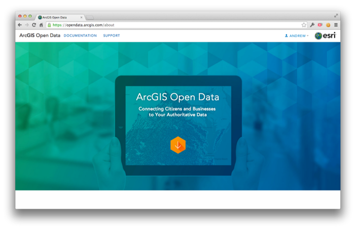
Last Thursday Esri announced the launch of the 'ArcGIS Open Data' initiative in beta. Having this major player enhancing access, in their own way, to open geospatial data can only help.

From their announcement: "Starting today any ArcGIS Online organization can enable open data, specify open data groups and create and publicize their open data through a simple, hosted and best practices web application. [...] For you Data Providers, you can participate in open data in a few ways. Foremost you can specify open data groups and items in your organization. By doing so, you indicate to the community that this data is open to be shared, downloaded, and reused in other open data sites and applications. You don’t need to actually host your own site for your data to be valuable to others. [...] On the other side, Data Consumers such as citizens, businesses and developers can begin using their local open data sites to quickly access and download data in a variety of common formats: KML, Spreadsheet (CSV), Shapefile, GeoJSON and GeoServices. As the US Open Data Institute recently noted suggested the impact to opening government data if software had ‘Export as JSON’ by default. That’s what you now have. Users can also subscribe to the RSS feed of updates and comments about any dataset in order to keep up with new releases or relevant supporting information."

Read More »

GDAL/OGR 1.11.0 Released: GeoPackage, Google Map Engine and OpenFileGDB Drivers and more

If there's one geospatial library that is ubiquitous, both in open source and proprietary software, it's that one. Lots of users may not even know they're indirectly using the open source GDAL/OGR library. Well, about a year after version 1.10.0, this widely used tool is now improved with this new version, GDAL/OGR 1.11.0.

The major changes according to the release notes:

  • New GDAL drivers:
    •  KRO: read/write support for KRO KOKOR Raw format
  • New OGR drivers:
    •  CartoDB : read/write support
    • GME (Google Map Engine) : read/write support
    •  GPKG (GeoPackage): read-write support (vector part of the spec.)
    •  OpenFileGDB: read-only support (no external dependency)
    •  SXF: read-only support
    •  WALK : read-only support
    •  WAsP .map : read-write support
  • Significantly improved drivers: GML, LIBKML
  • RFC 40: enhanced RAT support (#5129)
  • RFC 41: multiple geometry fields support
  • RFC 42: OGR Layer laundered field lookup
  • RFC 43: add GDALMajorObject::GetMetadataDomainList?() (#5275)
  • RFC 45: GDAL datasets and raster bands as virtual memory mapping
  • Upgrade to EPSG 8.2 database
Read More »

Batch Geonews: Get Your Google Glass on April 15, TopoJSON, GDAL/OGR for ArcGIS, Ukraine Maps, and much more

Here's the recent geonews in batch mode.

On the open source / open data front:

  • Here's AmigoCloud's open source GDAL/OGR plugin for ArcGIS
  • I learned about dat, an open source 'data management package' with revision control, with similarities (competing with?) with GeoGit, related, GeoGit for Python: Announcing geogit-py
  • We already told you about GeoJSON over GitHub, but you can go further with GitSpatial, a spatial API for GitHub-hosted GeoJSON files
  • MySQL trying to catch up PostGIS, MySQL 5.7 GIS building on Boost Geometry
  • GeoA shares an entry on StoryMap JS: Tell your own story using the Open-Source Story Map tool
  • Amongst recent software updates, MapTiler 0.5.3
  • More editing ahead, 500,000 km2 Satellite Imagery Update for OpenStreetMap Tracing, meanwhile you can do it yourself; Drone Adventures Imagery for Tracing in OpenStreetMap: Fukushima + Lima

On the Esri front:

  • 'Explorer for ArcGIS', yes, that's for this month on iOS, Explorer for ArcGIS is coming!
  • Interoperability, Using OpenLayers to work with REST and OGC services from ArcGIS Server
  • 2TB of new imagery, New DigitalGlobe content released in World Imagery basemap
  • Updated, ArcGIS API for JavaScript Version 3.9 Released
  • Becoming open, Esri ArcGIS Open Data Update

On the Google front:

  • That's it, anyone in the U.S. can finally buy their own Google Glasses, but if you want one, you need to buy it on Tuesday April 15 or wait until it becomes really available to everyone, anytime, Anyone Can Buy Google Glass April 15 and directly over CNN, Google Glass available to anyone for one day only - and yes, quantities are limited
  • A generic and informative article About Google Earth Imagery
  • With the data layer, Build a map infographic with Google Maps & JavaScript
  • Maps everywhere, USGS Maps in Google Maps Gallery
  • Angkor Wat, Wander through Angkor’s thousand-year-old temples on Street View
  • Another article on The obscured areas of Google Earth

Discussed over Slashdot:

  • Thanks open licenses, New York Public Library Releases Over 20,000 Hi-Res Maps
  • Another way to do 3D viz,  3D Display Uses Misted Water
  • Taxi sharing, Taxis By Algorithm: Streamlining City Transport With Graph Theory
  • Still possible in, Russian GLONASS Down For 12 Hours
  • Crowdsourced traffic app, In Israel, Class-Action Plaintiff Requests Waze Source Code Under GPL
  • Location privacy once again, London's Public Bike Data Can Tell Everyone Where You've Been
  • A map of submarine cables, Oxford Internet Institute Creates Internet "Tube" Map
  • Another kind of map, Physicists Produce Antineutrino Map of the World
  • Thanks OpenStreetMap once again, Racing To Contain Ebola, the map on MapBox: Mapping an entire city in a day

In the everything else category:

  • We never specifically addressed the TopoJSON format, which is topological GeoJSON, related, GeoJSON for linked data, The GeoJSON-LD project
  • A post that clearly demonstrates why GML was never a good solution: GML madness, hope GeoPackage will be a better one
  • We never really mentioned the Internet of Things yet, worth reading a bit about this current buzz word since it has obvious geolocation ties, related, The Internet of Things forecasted to include 26 billion intelligent devices by
  • Another informative entry on what is geofencing, Geofencing And My Business
  • An why not, Cloak – location-based anti-social app lets you avoid annoying friends and exes
  • A Make article on DIY Satellites: Now and Near Future and another one named Your Own Satellite: 7 Things to Know Before You Go
  • Here's why remote sensing is a profession, Earth observation data and revenue generation; the catch and guidelines and it's evolving fast, Earth observation satellite startups set to transform the EO imaging ecosystem
  • Corporate privacy is dead too, monitor Saudi Arabia oil reserves from satellites, Monitoring Oil reserves from Space

In the maps category:

  • GeoCurrents offers a series over Ukraine, Ukrainian Regionalism and the Federal Option, Energy Issues in the Ukrainian Crisis and Russian Envelopment? Ukraine’s Geopolitical Complexities, also related, How cartographers should map Crimea?
  • In the UK? UK Air Pollution Forecast Map
  • Maps is money, The interactive map of taxi trips in New York city
  • And a map of companies and their worldwide presence OpenCorporates Maps by KILN
  • Fiction maps, The Secrets and Clues of the Official Game of Thrones Maps and why not, The Geology of 'Game of Thrones'
Read More »

Batch Geonews: PyQGIS Book, More GeoGit, Android Wear, Sub-meter Bathymetry, Google Maps Supports GeoJSON, and much more

Here's the recent geonews in batch mode.

From the open source / open data front:

  • FOSS4G announced their opening keynote speaker, Mike Bostock of D3.js fame
  • This was published as a PR, Extending QGIS Just Got Easier with The PyQGIS Programmer's Guide
  • In the same category, Book Review: PostGIS Cookbook
  • 3D in open source GIS is getting to a nice state, 3D viz with QGIS & three.js
  • Open source PGRestAPI, a Node.js REST API for PostgreSQL Spatial Entities
  • New versions, GeoTools 11.0 released and so was OSGeo-Live 7.9
  • News from GeoGit, GeoGit in Action: Distributed Versioning for Geospatial Data
  • Interesting news from OL3, OpenLayers 3 Vector Rendering: Topology-Preserving Simplification
  • OpenStreetMap and open data generate plenty of offsprings, from OpenSnowMap to OpenLoveMap
  • And the question of the license is never fully closed, OpenStreetMap: Is share-alike restrictive for spatial data?

From the Esri front:

  • Here the What’s New in ArcGIS Online (March)
  • Esri announced Routing Enhancements to ArcGIS Online
  • They are also Introducing the Find, Edit, and Filter app for ArcGIS Online

From the Google front:

  • Wearables are inherently geospatial, I make links between the new Android Wear project and this O'Reilly article named Wearing the future
  • Google Maps now supports GeoJSON, Maps made easier: GeoJSON in the JavaScript Maps API
  • A followup on a previous story, Hands On: Project Tango, Google’s 3D-Scanning Phone for Makers, also, Google's Project Tango Headed To International Space Station
  • An upcoming webinar named Combining Google Maps and Google Search to Empower Decision Making
  • Embedding Google Maps, Adding the new Google Maps to your website just got easier with the new Google Maps Embed API
  • There's a lot to love with the new Google Maps, but GeoAwesomeness shares 4 things I hate about new Google Maps
  • Ok, if you have some free time, here's a nice game to discover the world, guess where the StreetView you're shown actually comes from with GeoGuessr
  • New data, Explore America’s most endangered river on Street View and Hawaii too, Aloha from Google Street View
  • Drown your town, Using Google Earth to predict sea level rise
  • Art and map content gives us Art from infrastructure: the art of Google Maps

Geo-related discussions over Slashdot:

  • An open discussion on the Easiest To Use Multi-User Map Editing?
  • You car is being tracked, Vast Surveillance Network Powered By Repo Men
  • Still on privacy, Cops Say NDA Kept Them from Notifying Courts About Cell Phone Tracking Gadget
  • It could have been another service, Using Google Maps To Intercept FBI and Secret Service Calls
  • The Navy too, Navy Database Tracks Civilians' Parking Tickets, Fender-Benders
  • And why not track all cars? L.A. Police: All Cars In L.A. Are Under Investigation
  • Visualization, Key Routes and Communities In London's Bike Rental Network
  • For now, Using Handheld Phone GPS While Driving Is Legal In California

In the everything else category:

  • We mentioned a few times iBeacons, here's you chance to catch up, O'Reilly publishes an article named iBeacon basics
  • Bing Maps Developers blog is shut down, what does this say about Microsoft's interest in mapping technologies?
  • The father of GIS died, and it's time from an history lesson with this entry named Geospatial computerization in the 1960s: The Canada Land Inventory
  • For yourself or colleagues? Another open geospatial course, Skills for the Digital Earth, Open for Registration
  • I have failed to make it work, but it's based on Leaflet and MapBox, a new virtual globe AtomJump Javascript 3D Earth API
  • While not under Google's wings anymore, it is still alive and well, SketchUp and a refreshed 3D Warehouse released
  • MapBox, one of the popular geoenterprises, is Launching Mapbox Enterprise, which is essentially the same great MapBox services for aimed at large clients
  • Indoor mapping being revolutionized, Wired's We Mapped Our Boss’ Office With This Slick New 3-D Camera
  • Indoor mapping is a la mode, TomTom enters “Indoor”
  • Tablets and geospatial; First app for LiDAR data visualisation on iPad
  • Routing challenges, Helsinki’s personalized bus service is like Uber for public transit
  • Talking of transit, Apple Maps to Include Transit Directions, Improved Points of Interest Data in iOS 8
  • There's the 17th AGILE Conference on Geographic Information Science next June in Spain
  • A Spatial Law perspective on UAVs in the US
  • Meanwhile, more EO satellites gets into space, Planet Labs' Flock 1 comprised of 28 Earth observation Cubesats deployed from ISS
  • Bathymetry? Worth a look, Satellite-derived bathymetry at sub-meter level from EOMAP and Satrec Initiative

In the maps category:

  • This MapBox overlay is pretty nice, Global Elevation Data on Satellite Imagery
  • A map of solar time vs clock time for each timezone, How Wrong Is Your Clock?
  • Hungry? Country maps made of food
Read More »

Testing web map APIs - Google vs OpenLayers vs Leaflet

Geospatial technologies evolve quickly, here's a fresh comparison of web mapping API and libraries, Testing web map APIs - Google vs OpenLayers vs Leaflet.

From the conclusion: "Google, for example, can easily insert adverts into its maps without us knowing. Leaflet and OpenLayers, being open source, cannot. That said, if your aim is just to get attractive 'off the shelf' maps up quickly, Google Maps is a good option. OpenLayers is mature and big and works well with servers. Leaflet, as the new kid on the block is the most exciting for me and encapsulates many of the benefits of open source software in general: speed of development, flexibility, efficiency. [...] Lightness considered, for me that would mean Leaflet for many applications, but watch this space for the final version of OpenLayers3 (due very soon) and perhaps even better web mapping options."

Read More »

EPSG - Find Coordinate Systems Worldwide

Lots of us need to find datum / CRS info from time to time, and there's a new website to help us:  EPSG: Find Coordinate Systems Worldwide. The whole website and content is open source.

The main features according to the announcement:

  • Fulltext search for the complete database of coordinate systems from EPSG
  • Short rememberable URLs.
  • Type GPS latitude/longitude and get projected coordinates or vice versa
  • Precise numerical location on a map / aerial photo for any place on the planet
  • Export definitions in various formats, including WKT, OGC GML, XML, Proj.4, SQL, JS, etc.
  • Facets for retrieval of alternative record types from the official EPSG database
  • API for the search in EPSG database and for transformations

There already was spatialreference offering a similar service, the FAQ in the announcement explains how EPSG differs.

Read More »