Geonews

Geonews category

FOSS4G Europe: edition

The second edition of the FOSS4G-Europe Conference is held this week at Politecnico di Milano in Como, Italy. A day of workshops will precede the conference on 14th July, and a code sprint will close the event on 18th July.

400 people would be in Italy for the entire week to attend 100+ talks and 12 workshops.

A new event meters enabled by beacons & Internet of things is in place and follow closely by FOSS4G-Europe.


The Conference aims to bring together FOSS4G users and developers worldwide and foster closer interactions with and amongst European communities in order to share ideas for improving geodata, software and applications openess.

After 10 years, Slashgeo is ending its journey

The short story is this one — after 10 years of manually selecting and aggregating the best geospatial news to share with the community, Slashgeo has ended its journey and will now cease publication.

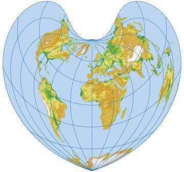
The longer story involves abusing the Bonne projection, being mesmerized by our magnificent planet seen through the eyes of satellites and drones, finding my way within the avalanche of crowdsourced and open geodata, feeling like floating and flying around the globe into new dimensions thanks to virtual globes and augmented reality. The future promises to be full of wonderful surprises for the geospatial professionals!

No, my love for geospatial has not waned and my day job still has ‘geospatial’ in its title. But I find myself in a professional position where I don’t want to the spend the time to ‘fix’ Slashgeo to make it what I’d like it to be and where finding the time to aggregate geonews has become more labor than fun. When I launched Slashgeo in, I envisioned it as a tool for the geospatial community by the geospatial community. While a handful of Slashgeo editors contributed to the project over the past 10 years, and I have to sincerely thank them for their contributions, Slashgeo never became self-sustaining.

Stats don’t really matter at this point right? Slashgeo nonetheless published several thousands geospatial news, in the adventure our newsletter reached thousands of subscribers and website analytics informed me that the geonews we shared with the community was reaching over 10,000 geospatial professionals. Not a bad achievement! We also received tens of donations over the past 10 years, this really made a difference and encouraged me to go on.

Now what? I don’t want to leave you, our dear users, in the dark. Since I’ll most probably continue reading geospatial news anyway, my plan is to share the ones I find worthy via the Slashgeo Twitter account. To be honest, I don’t like Twitter, I hate its low signal/noise ratio — Slashgeo was there exactly to provide a high signal/noise ratio to geogeeks — but that’s the best compromise I found so far. Of course, you can read other geospatial news sources, the ones I recommend are Planet OSGeo since geospatial open source is part of our future - even if you get a strange mix of entries from that source, the Google LatLong blog since whatever they do, with the ubiquity of Android, Google Maps and impacts of their geo-projects, they can’t be ignored, I also invite you to read the Mapbox blog because it’s a company I admire for their contributions to geospatial in general and to open source and OpenStreetMap in specific — they lead plenty of great projects, including turf.js, and finally, if you’re looking for a generic geospatial news website, I consider GeoAwesomeness the best one around at the moment, actually much better than Slashgeo lately!

I am a man of passion. And I have many of them. Aside from my family and kids, I’m also devoting more and more time to music. My first CD was released in before Slashgeo came to life, my second one, named ‘Unanimoog, escape inside the music’, was released on the last day. I warn you right away, it’s not music you would hear on the radio (yet?) and you may not like that kind of synthetic sounds at all. It’s an album 100% made with a single award-winning iPad app, Animoog, no loops, no sequencer, no effects, no hardware involved other than the iPad. If you’re into music, you know that Moog has a cult status. I’ve been lucky and my album made the front page of Moog Music’s website and has been acclaimed by many, including in this Create Digital Music article. Here’s the first of the amateur and homemade videos I recorded live with the default iTunes visualizer (undocumented iTunes visualizer keyboard shortcuts described here). Because the presets I leverage feature omnipresent ping pong stereo panning, you need headphones to enjoy such music.

Here’s another one of the 47 tracks of the album, named ‘don’t June’. Headphones still required. The whole album, like mostly everything I do, is not only free to download, but also creative-commons licenced.

Thanks for the past 10 years and enjoy life! — Alex / Satri for Slashgeo.

pygeometa: New Geospatial Metadata Package

pygeometa is a new open source Python package to generate metadata for geospatial datasets. Users can manage simple configurations to generate geospatial metadata in a variety of formats.

Features:

  • simple configuration: inspired by Python’s ConfigParser
  • extensible: template architecture allows for easy addition of new metadata formats
  • flexible: use as a command-line tool or integrate as a library

Recent Slashgeo Donations - Thank You!

At Slashgeo, we aggregate and publish geonews on a volunteering basis and we benefit from user donations that contribute paying the hosting fees. I’d like to sincerely thank Max Galka who made a significant donation to Slashgeo. Such contributions not only reduce the financial burden of hosting this site we provide for the community, but also energize us! Thank you Max :-)

I must also thank Andrew Zolnai for his financial contribution, Andrew also regularly submit content to Slashgeo. Thanks Andrew! All contributions are welcomed, even if it’s only 5$. Major donors are listed in the ‘Top Slashgeo Donors’ box on every Slashgeo page. And of course, you can also contribute great geospatial content to be published, which is essentially our main value at Slashgeo. Sincere regards — Alex for Slashgeo.

GIS Programming: Languages breakdown

Coding skills are now a requirement for lots of geospatial practitioners, here’s a recent and useful summary named GIS Programming: Languages breakdown.

From the article: “Unlike Fortran, C/C++ is still in widespread use, in the GIS-field it’s beeing used for several desptop applications of some age, as well as in what I’ll call the “first wave” of open source libraries and utilities. Notable mentions are PostGIS, OGR/GDAL, PROJ.4 and Mapserver. […] Java libraries was the “second wave” of open source GIS, and brought us libraries and tools like GeoServer, GeoTools, JTS and GeoWebCache. Just because of GeoServer I think you should know some Java to get along as a GIS-developer. […] Python has beed adopted by ESRI as the scripting language of choice for their ArcGIS-platform, as well as by QGIS, where you have access to a python REPL and can write plugins using Python. […] Python is a really great programming language in itself, easy to grasp, enforces clean, readable code, and with the usage both in ESRI and QGIS it’s a language that you most definably should know it you work with GIS. […] From the advent of Google Maps and OpenLayers, JavaScript found it’s place in the GIS-domain as the language to write web map clients in (that is, after people realized that Flash and Sliverlight where blind alleys). Now there is a large ecosystem of browser-libraries, such as OpenLayers 2 & 3, Leaflet, mapbox-gl-js, proj4js and several more.”

Wikimedia European History Map over almost 2500 years

Andrew’s bloggage update: Created a video of some of the cool Wikimedia Atlas of European maps. Downloaded the images, rubber sheeted them and composited each map sheet in YouTube - if you squint you’ll see the four red dots I used as projection reference. This is a useful skill as crowd-sourcing emerges as a tool for good, be it for HOT Nepal maps for earthquake relief, or to geo-reference some of the million British Library maps.

FOSS4G-Europe : Mapping parties, workshops & keynotes

The second edition of the FOSS4G-Europe Conference will be held at Politecnico di Milano in Como, Italy, from July 15th to 17th. The Conference aims to bring together FOSS4G users and developers worldwide and foster closer interactions with and amongst European communities in order to share ideas for improving geodata, software and applications openess.

This week FOSS4G-Europe announced its Mapping parties, updated list of workshops and 2 new keynotes speakers.


1. Mapping Parties
Mapping Parties are FOSS4G events where people meet up for making and having fun.
They will take place in Como on Wednesday, July 15th.
   
In the true spirit of mapping parties ANYONE is welcome and can participate. The organized mapping parties are:
  • OpenStreetMap mapping party
  • Indoor mapping party
  • Land coverage validation game
  • Emotional mapping


2. Workshops
Seats still available for workshops and  here is a reminder for the programmed workshops:
  • Raster and vector processing with GDAL
  • How to write a Python GRASS GIS 7 addon
  • Analysis with QGIS
  • Land cover mapping with high resolution satellite images using Orfeo Toolbox, QGIS and OSM
  • R for spatial data
  • Free and open source software for kinematic GNSS positioning
  • Deploying Web Processing Services using ZOO-Project - Examples Python WPS using PgRouting
  • GeoServer on steroids: getting the best out of GeoServer
  • Geopaparazzi: never out of data in the field
  • FOSS4G routing with pgRouting, OpenStreetMap and OpenLayers 3
  • Spatio-temporal Big Data: the Rasdaman approach in the context of the PublicaMundi project
  • SensorWeb and IoT with OpenSensorHub

3. Keynotes

Here ar the two new keynotes speakers: 

- Jeff McKenna, President, OSGEO Foundation

- Jun Chen, President, International Society of Photogrammetry and Remote Sensing

As a reminder here are the previously announced:

Alessandro Annoni, Head of Digital Earth and Reference Data Unit, European Commission’s Joint Research Center
Georg Gartner, President, International Cartographic Association
Patrick Hogan, NASA World Wind Project Manager, NASA
Ki Joune Li, Professor,  Pusan National University


Batch Geonews: Centimeters GNSS Accuracy from Smartphones, Google Maps + StreetView in Legos, Google Earth in VR, and much more

Here’s the recent geonews in batch mode.

From the open source / open data front:

  • Popular nowadays, Considering a Hybrid Proprietary/Open-Source Architecture
  • Here’s a followup regarding the Open Letter for LiDAR standards, for which Esri’s Jack Dangermond himself provided feedback
  • With the open source GeoMesa that is almost ready for release, Google & GeoServer Support Geospatial Big Data in the Cloud
  • Nice QGIS effect, Trajectory animations with fadeout effect
  • A GUI can’t hurt, Web-based configuration for MapProxy
  • Second edition is available, PostGIS In Action 2nd Fresh off the presses

From the Esri front:

  • Updated data, U.S. Esri Demographic data is now available
  • Drive your city, CityEngine .0 released
  • We never mentioned that product before, Esri Maps for IBM Cognos 6.0.2 Released
  • We mentioned the Nepal crisis quite a few times, but not the efforts from Esri yet, there you go! Maps and Imagery of the Nepal Earthquake

From the Google front:

  • A kid’s dream, Google Maps in Lego form & Brick Street View
  • That’s cool too, Wearality, Bringing Google Earth to VR
  • There’s New Street View in Madagascar and Canadian Parks
  • Expect this feature widely available soon, Google Maps now allows sending directions from computer to app
  • The normal difficulties of crowdsourcing, Google Maps Edits Cause Embarrassment, Android peeing on Apple
  • Why not, The Planet Mercury in Google Earth
  • It’s back, Place IDs in the Google Geocoding API
  • And oh, there was a minor bugfix release - the first update in 2 years!, New Version of Google Earth 7.1.4.1529

Discussed over Slashdot:

  • Under the sun, Interactive Map Exposes the World’s Most Murderous Places
  • We knew this already, Uber Wants To Buy Nokia’s Mapping Services
  • They follow you until they deliver, Amazon’s Delivery Drones Will Be Able To Track Your Location
  • Global village, Europe Vows To Get Rid of Geo-Blocking
  • Again, in the US, Police Can Obtain Cellphone Location Records Without a Warrant
  • The police in your hands, Traffic App Waze To Alert L.A. Drivers of Kidnappings and Hit-and-Runs
  • 3D soon everywhere, Intel Showcases RealSense 3D Camera Applications and Technologies In New York
  • Everywhere really, Microsoft Integrates Autodesk’s 3D Printing Platform Spark Into Windows 10

In the everything-else category:

  • Article on significantly improving smartphone’s GNSS accuracy to centimeters, Accuracy in the Palm of Your Hand (also discussed over Slashdot)
  • HoloLens for architecture, engineering and construction, Trimble and Microsoft Hololens to the AEC industry
  • It’s third year, first time I hear about it, the World Geospatial Developers Conference, with 6000+ attendees
  • In time of crisis, How Satellites Can Monitor California’s Underground Water
  • Understanding crisis, What Satellite Data Tells Us About Nepal’s Brutal Quake and don’t forget interferometry, Nepal earthquake deformations
  • Satellites everywhere, Nanosatellite and microsatellite market forecast to reach $2 billion by
  • New WorldDEM global DEM at high resolution, but it’s not cheap
  • Self-driving cars: incremental or sudden change? It may well be incremental according to this interesting Wired article, while the next one is discussed over Slashdot, Self-Driving Cars In California: 4 Out of 48 Have Accidents, None Their Fault
  • Location and the Internet of Things, Google’s Physical Web vs Apple’s iBeacon, and it appears Twitter invests in iBeacons
  • What can be done with a smartwatch and location, 10 best location-based apps for Apple Watch
  • Interesting from the OGC, Linked data versus geospatial semantics: Where do you stand?
  • In recent releases (via VS), Geomatica released and FME .1

In the maps category:

  • Beautiful and alarming at the same time, NASA visualizes the year of Earth’s CO2 emissions
  • Historical maps in the US, It Just Got Easier to See a Cool Historical Maps Collection

OpenLayers 3.5.0 Released

The popular open source web mapping library OpenLayers 3.5.0 has been released.

Some of the new features according to the official blog: “Among the features in this release is a new snapping interaction. This can be used in conjunction with the draw and modify interactions to allow vector editing with snapping support. See the new snap example for a demonstration of its use. Adding to OpenLayers’ already excellent vector rendering and editing support, the Canvas renderer now supports a wrapX property on vector sources. Those in the mapping world have long known that the world is flat. But it is less common to accept that our flat world only has north and south edges while extending infinitely east and west. The wrapX property on vector sources (true by default) indicates that features will be rendered repeatedly as users pan east or west of the dateline. As if snapping and wrapping weren’t enough new vector functionality, the draw interaction now supports freehand drawing.  […] While we stand in allegiance with GeoJSON, you can now build support for Esri JSON into your applications. This adds to the already extensive feature format support of GeoJSON, GML, GPX, IGC, KML, Encoded Polyline, TopoJSON, and WKT.”

GeoNetwork OpenSource 3.0.0 Released

The popular geographic metadata catalog software GeoNetwork OpenSource just released version 3.0.0.

A reminder of what it is: “GeoNetwork is a catalog application to manage spatially referenced resources. It provides powerful metadata editing and search functions as well as an interactive web map viewer. It is currently used in numerous Spatial Data Infrastructure initiatives across the world.” Amongst the long list of new features:

  • Metadata Editor UX Improvements
  • Support for Hierarchical Faceted Search
  • Schema Formatters and Metadata Views
  • Metadata Massive Replace
  • Dublin Core Related Resources
  • Report module
  • Adding Register support to GeoNetwork