Cartoview is an open source web framework for managing and deploying geospatial and business Applications, the architecture of Cartoview makes it easy to efficiently develop and maintain and deploy GIS enterprise applications. The Cartoview App market offers a variety of apps that are simply deployed directly from the browser, the apps allow you to easily handle your spatial data under ESRI ...
Read More »Tag Archives: ArcGIS
Batch Geonews: QField, IndoorGML Standard, Focus on Google Maps for Work, 30m SRTM-DEM, and much more
The first batch-mode edition of the geonews. On the open source / open data front: There’s a new free course Introduction to Geospatial Technology Using QGIS (from Feb 23 - Mar 29) which also has content on GitHub Beautiful and simple, How to: watercolor pastel style in QGIS Announced is the FOSS4G-Europe conference, this time in Como, Italy, ...
Read More »Batch geonews: Google Earth API Deprecated, ArcGIS 10.3 Released, 2nd Learning QGIS, Nokia-Baidu Partnership, and much more
Here’s the last batch-mode edition, covering most of December. Might interest some of you, Slashgeo’s posts are now mirrored on Google+. Have an excellent holiday break. On the open source / open data front: More support for the standard, GDAL GeoPackage raster support Reading, The Book of OpenLayers 3, completed And another one announced, 2nd edition ...
Read More »Explore the power of ArcGIS Geodatabase
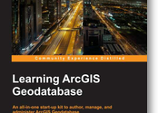
The geodatabase is the common data storage and management framework for ArcGIS. It combines “geo” (spatial data) with “database” (data repository) to create a central data repository for spatial data storage and management. It can be leveraged in desktop, server, or mobile environments and allows users to store GIS data in a central location for easy access and management. Learning ...
Read More »Batch Geonews: WorldView-3 Launched, UK to Allow Autonomous Cars, ArcGIS Pro, MapBox GL, and much more
This is an unusually long edition of the geonews in batch mode, covering all of our Summer break. On the Esri front: A nice summary, Twelve Things Worth Knowing from Esri User Conference Q&A More options is good, Introducing Esri’s World Elevation Services It’s not ‘beta’ anymore, ArcGIS Open Data production APB discuss the upcoming 64-bits friendly ArcGIS Pro ...
Read More »Winners of the ArcGIS Book Contest
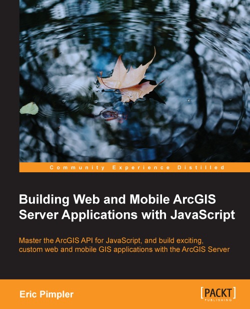
Packt Publishing and Slashgeo are happy to announce the 10 winners of the 'Give Away Contest - Grab a chance to win a free ArcGIS Book eCopy!'. Winners were chosen amongst participants over Slashgeo, and the GIS and ArcGIS Server groups on LinkedIn. Congratulations to winners!
The prizes were a free digital copy of "Building Web and Mobile ArcGIS Server Applications with JavaScript" written by Eric Pimpler.
Read More »Announcing the ArcGIS Pro Beta Program
This new software was announced last week. I waited for more information and reactions before sharing it with you, but I haven't found any solid analysis or reviews so far. Esri announced the ArcGIS Pro beta program.
From the announcement: "Esri is pleased to announce the beta release of ArcGIS Pro, which is a new ArcGIS for Desktop application that provides many exciting features. ArcGIS Pro is designed for GIS professionals who need to visualize, edit, and perform analysis—in both 2D and 3D. All current ArcGIS for Desktop customers are invited to download ArcGIS Pro and participate in its beta program. Your work in ArcGIS Pro is organized into projects, which bring together all the resources you need to complete your GIS tasks. You can store as many maps and layouts as you need in the same project, and you can open multiple maps at once and view them side by side. You can package your projects to collaborate with others, or share your work as web maps and web layers. ArcGIS Pro can use local data, as well as content from your ArcGIS Online or Portal for ArcGIS organization. ArcGIS Pro is a 64-bit, multi-threaded application with a modern user experience that runs on the Windows platform."
Batch Geonews: OpenAddresses, csw4js, GeoPackage Support in ArcGIS, Historic Street View, and much more
Here's the recent geonews in batch mode.
On the open source / open data front:
- We talked about the beta OpenAddresses in, now OpenAddresses has launched
- Here's thoughts from State of the Map US and Peter Batty's report of SofM US, including the new Vector Tiles for OpenStreetMap and discussion over licensing
- A new open source project, the missing CSW library for JavaScript: csw4js
- Using QGIS? Learn more about Composition styling in QGIS 2.2
- In software updates, GeoServer-Manager 1.6.0 released and GeoTools 10.6 Released
On the Esri front:
- Good news for standards, support for OGC GeoPackage specification in ArcGIS.
- A fourth Esri app for iPad and iPhones, Now Available: Explorer for ArcGIS on iPad and iPhone, "Explorer for ArcGIS gives you a first class experience for accessing your geospatial data on a mobile device."
- More openness at Esri, ArcGIS Solutions symbols now have a repo on GitHub, of course, don't forget about the open Maki geo-symbols
- There's an upcoming free online seminar on Arc2Earth and Using Google Maps Inside Esri’s ArcGIS
- Esri has a New Ocean Basemap
On the Google front:
- We can now browse StreetView "historical" imagery, Go back in time with Street View
- The two are slowly merging, The long history of Google Earth in Google Maps
- Interesting, a book on The History of the World with Google Earth
- In the official Google blog, The latest chapter for the self-driving car: mastering city street driving, and Slashdot discusses Google Using Self-Driving Car Data To Make Cars Smarter
- Eyes in the sky, Google Buys Drone Maker Titan Aerospace
- Ogle Earth shares an entry named What does Crimea tell us about Google?
- As there frequently is, New Google Earth Imagery – May 1, and this one too, New Google Earth Imagery – April 16
In the miscellaneous category:
- Want to understand MapBox via educational guides? Introducing Mapbox Foundations and they also have two new products, Mapbox Launches Smart Directions and Introducing Mapbox Outdoors
- In Europe? The final Copernicus Regulation has been published, "Copernicus, previously known as GMES (Global Monitoring for Environment and Security), is the European Programme for the establishment of a European capacity for Earth Observation."
- Impacts of Ukraine, Russian sanctions have killed Canadian satellite launch
- Not the first we mention this, The Commoditization of the Earth Observation Satellite Business
- Google Glass? You can build your own, DIY Wearable Pi With Near-Eye Video Glasses
- O'Reilly has a long and informative entry on iBeacons, privacy, and security
- Also Apple-related, Apple acquired 24 companies in the past 18 months, including several mapping apps, including BroadMap, Embark, HopStop, Locationary, and WiFiSlam, along with other notable additions like 3D company PrimeSense
- And yes, Apple and Google can work together sometimes, Google's 'Project Tango' Smartphone Uses Apple's PrimeSense Technology
- MapQuest playing nice with popular open source libraries, Announcing MapQuest Plugins for Leaflet on Licensed and Open Data
- Remote sensing and mapping of citizens, Eyes Over Compton: How Police Spied On a Whole City
- If you haven't heard of 'Nearby Friends' yet, New Facebook Phone App Lets You Stalk Your Friends
- It's Facebook so it must matters? ;-) Facebook acquires activity-tracking app Moves
- A discussion regarding The Best Parking Apps You've Never Heard Of and Why You Haven't
- 3D coming to your phone? Amazon's Smartphone with 3D Capabilities Revealed in New Photos
- Based on where you live, UK Life Expectancy and Spatial Analysis
In the maps category:
- Via APB, a map of the Countries With The Worst Suicide Rates
- Wired published a story named 400 Years of Beautiful, Historical, and Powerful Globes
- Also from Wired, 18 Maps From When the World Thought California Was an Island
- An atlas, Global Renewable Energy Atlas
- TMR mentions two books about Art and Personal Mapmaking
- And if you're into poems, Map – poem by Wislawa Szymborska
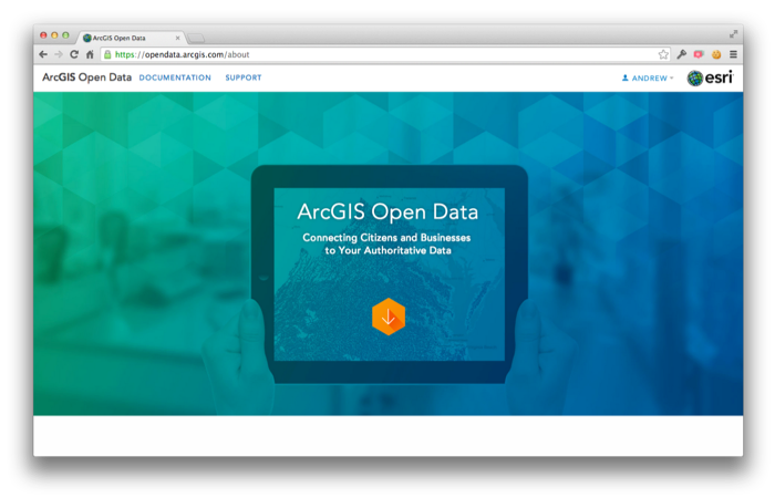
Esri Launches ‘ArcGIS Open Data’ in Beta
Last Thursday Esri announced the launch of the 'ArcGIS Open Data' initiative in beta. Having this major player enhancing access, in their own way, to open geospatial data can only help.
From their announcement: "Starting today any ArcGIS Online organization can enable open data, specify open data groups and create and publicize their open data through a simple, hosted and best practices web application. [...] For you Data Providers, you can participate in open data in a few ways. Foremost you can specify open data groups and items in your organization. By doing so, you indicate to the community that this data is open to be shared, downloaded, and reused in other open data sites and applications. You don’t need to actually host your own site for your data to be valuable to others. [...] On the other side, Data Consumers such as citizens, businesses and developers can begin using their local open data sites to quickly access and download data in a variety of common formats: KML, Spreadsheet (CSV), Shapefile, GeoJSON and GeoServices. As the US Open Data Institute recently noted suggested the impact to opening government data if software had ‘Export as JSON’ by default. That’s what you now have. Users can also subscribe to the RSS feed of updates and comments about any dataset in order to keep up with new releases or relevant supporting information."
Give Away Contest - Grab a chance to win a free ArcGIS Book eCopy!
Hold a chance to win free copy of Building Web and Mobile ArcGIS Server Applications with JavaScript written by 'Eric Pimpler', just by commenting! For the contest we have 5 eBooks to be given away to 5 lucky winners.
How you can win:
To win your copy of this book, all you need to do is visit the book page and come up with a comment below highlighting the reason “why you would like to win this book” and share a post about this book with this unique short link on your social media profiles: Don’t forget to drop your email address and the permalink of your social media post in your comment.
Note: Social Media post must contain this unique short link:
Duration of the contest & selection of winners: The contest is valid till 11th May. Winners will be selected on the basis of their comment posted.
For more information about the book visit book page:
Read More »