We would like to inform you of the availability of presentations, posters and articles presented during the 10th International gvSIG Conference [1], which were held from December 3rd to 5th in Valencia (Spain). The videos of the report sessions and workshops are also available to be visualized online. All the videos are available with English and Spanish audio, excepting the ...
Read More »Tag Archives: conference
Free workshops about “gvSIG 2.1 New features” and “Scripting on gvSIG 2.1”
On Friday December 5th, there will be two workshops, free of charge, about “gvSIG 2.1 New features” and “Scripting on gvSIG 2.1” at the 10th International gvSIG Conference (Valencia (Spain)). Both workshops will have Spanish-English simultaneous interpretation. All the information about them is at the gvSIG blog: In reference to the Scripting workshop, if you are interested ...
Read More »Slashgeo is a proud media partner of FOSS4G-Asia
We are happy to inform you that Slashgeo will be a proud media partner of the upcoming Free & Open Source Solutions for GIS (FOSS4G) - Asia conference held in Bangkok, Thailand, 2-5 December! FOSS4G-Asia aims to bring together FOSS4G users and developers worldwide and foster closer interactions with and amongst Asian communities in order to ...
Read More »FOSS4G Wrap-Up
FOSS4G took place 2 weeks ago and here’s what you should not miss. First, if you’re like me and you couldn’t make it on-site this year, rejoice, all the FOSS4G sessions have been recorded and are available for free. Here’s the schedule to pinpoint all the talks you want to see, then, once you’re convinced there’s way too many ...
Read More »FOSS4G: Live Stream, Birds of a Feather, Map Gallery, Parties - and more
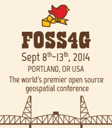
September 5, Portland, Oregon, USA Live Stream, Birds of a Feather, Map Gallery, Parties - and more Updated schedule and conference live stream The schedule [1] has been updated with the latest details and is full of great workshops, presentations, and events. Take a look and start sketching out your conference now to ensure that you don’t miss any crucial ...
Read More »FOSS4G: Extracurricular adventures, don’t forget the Map Gallery, and schedule updates
August 19, Portland, Oregon, USA Extracurricular adventures, don’t forget the Map Gallery, and schedule updates Your registration is paid (what? not yet? register now! [1]), your bags are near-packed, and now you’re wondering what else to do in Portland — in addition to a fantastic week of development, networking, and geo-geek revelry. See below for things you map have ...
Read More »10th International gvSIG Conference: “Strategies for the 21st Century”
The 10th International gvSIG Conference, organized by the gvSIG Association, will be held from December 3rd to 5th at La Petxina Sports-Cultural Complex (Valencia - Spain), under the slogan “Strategies for the 21st Century”.
Read More »Remote Sensing Summer School: new era of research for students.
For its third edition, the Remote Sensing Summer School (RSSS) has put in Quebec City (Canada) together ten world-class lectures with 40+ curious students from all continents. This Summer School has been initiated recently each time before the International Geoscience and Remote Sensing Symposium (IGARSS) supported by the GeoScience and Remote Sensing Society (GRSS). This event organized by INRS-ETE ...
Read More »FOSS4G-Europe – Early Bird Registration extended to May 30
It’s been a busy few weeks as things start to come together for FOSS4G Europe – but now, admittedly with some delay, we have managed the challenge of compiling an exciting program, to be published over the next days.
To give everyone time to have a look at the schedule before booking, we’ve extended the Early Bird registration deadline to May 30. In the meantime, many thanks to all who submitted abstracts – it has been a challenge to select the best of all excellent submissions passed in the last weeks. Altogether, the conference received about 78 abstracts in the general and 16 for the academic track. Every abstract has been carefully evaluated by the program committee to obtain a fair ranking.
On the whole there has been a very satisfying presence of topics relating to the relevant Open-Source- tools like GeoServer, MapServer, Zoo, rasdaman, Grass, and several more. As well OGC-standards like WMS, WMS, WCS, WCPS, WPS, and SOS have the attention of the community. All in all the bandwidth of proposals shows a good representation of the general trends in the geospatial world. In addition the Local Organizing Committee has secured facilities to run additional workshops and a code sprint during the conference.
A lot of registrations form Europe and beyond have poured in already, so make sure you are part of the crowd in this visionary European geo happening.
Read More »FOSS4G community voting open through May 5th
April 22
Portland, OR, USA
Community voting open through May 5th
What presentations do you want to see at FOSS4G? Now is the time to tell us!
The FOSS4G community at large can now read and score potential presentations. The conference committee will use the aggregate scores from the community review process to help choose which presentations to accept, and to assign presentations to appropriately sized rooms.
The community review process is an important part of creating a conference that benefits and reflects the community. Your input is a significant part of what makes FOSS4G a great conference. Note that you do not need to be registered for the conference to vote. And remember, all presentations will be available online, so even if you are unable to attend, your vote matters.
Please complete your voting by May 5th.
Important Conference Dates
See the full calendar for more details.
- June 15th: Early bird registration ends
- Sept 8th-9th: Workshops
- Sept 10th-12th: Main Conference
- Sept 13th: Code Sprint
About FOSS4G
The annual FOSS4G conference is the largest global gathering focused on open source geospatial software. FOSS4G brings together developers, users, decision-makers and observers from a broad spectrum of organizations and fields of operation. Through six days of workshops, presentations, discussions, and cooperation, FOSS4G participants create effective and relevant geospatial products, standards, and protocols.
FOSS4G has been held all over the world and draws attendees from over 40 countries. Nottingham, England hosted the conference in. In, Portland, Oregon, USA will host FOSS4G’s tenth year.
About OSGeo
The Open Source Geospatial Foundation (OSGeo) was founded in to support and build the highest-quality open source geospatial software. The foundation's goal is to encourage the use and collaborative development of community-led projects, data development and education. Many projects live under the OSGeo umbrella, including FOSS4G.
About PDX-OSGeo - Portland Area and Oregon OSGeo Chapter
The PDX-OSGeo chapter of OSGeo has been meeting, discussing and promoting the use of open source geospatial technology. Chapter members often organize or present on open source software at regional geospatial conferences. PDX is the airport code and like the PDX airport, the group has a wide catchment area.
Sponsors
Silver Level Sponsors
![]()
![]()
Bronze Level Sponsors


![]()
Supporters
![]()
![]()


![]()
![]()
Media Partners
These leading geospatial media organizations have partnered with FOSS4G to keep their readers informed.
![]()
![]()
![]()
![]()
![]()
![]()
![]()
![]()
![]()
![]()

![]()
Read More »