Here’s the recent geonews in batch mode. From the open source / open data front: Popular nowadays, Considering a Hybrid Proprietary/Open-Source Architecture Here’s a followup regarding the Open Letter for LiDAR standards, for which Esri’s Jack Dangermond himself provided feedback With the open source GeoMesa that is almost ready for release, Google & GeoServer Support Geospatial Big Data in the ...
Read More »Tag Archives: GNSS
SuperPad Reveals NTRIP Solution to Achieve Centimeter Level Accuracy
Supergeo, the leading GIS software and solution provider, is going to release NTRIP solution on its Windows Mobile GIS app, SuperPad, for high accurate field data collection and geospatial workflow enhancement. SuperPad is a feature-rich mobile GIS application for field-based personnel to collect, edit, display and measure spatial data at a reasonable budget. The highly flexible development environment and ...
Read More »High Accuracy and Advanced Field Work with Latest SuperSurv
To meet the great needs of high accuracy field data collection and better workflow via modern GNSS technology, Supergeo, the leading GIS software and solution provider, announces the latest SuperSurv (Android), the GIS mapping app, which not only allows users to connect with and operate external Bluetooth GNSS devices, but also elevates field work efficiency with new averaging algorithms. ...
Read More »High Accuracy GIS Total Solution by FOIF SuperGIS
Supergeo Technologies, the global leading GIS software and solution provider, announced the cooperation with Suzhou FOIF Co. (FOIF) in providing worldwide surveyors with high accuracy GIS turnkey solution. Mobile GIS is the base to establish GIS infrastructure with field data. And, data accuracy determines the quality and following processing time and cost. However, traditional survey instruments or post-processing usually ...
Read More »Batch Geonews: Halloween Street View, Cesium 3D Terrains, India’s GNSS, Open Source Dronecode, and much more
Here’s the recent geonews in batch mode. On the open source / open data front: This is a must see, full instructions to Creating 3D terrains with Cesium Via O’Reilly, I became aware of Google’s open Material Design Icons on GitHub that can certainly be used for maps, reminiscent of the Maki and WorldWeatherSymbols amongst a few New lab, University ...
Read More »Batch Geonews: Google Drone Delivery, Galileo Satellites Failures, 100 New 3D Cities for Bing Maps, 1M NYC Buildings in OSM, and much more
Here’s the recent geonews in batch mode. On the open source / open data front: A webinar Friday next week named Introducing the QGIS Academy Project Nice to see, Over 1 million New York City buildings and addresses imported to OpenStreetMap Because that’s the kind of maps we want to show our friends, Showing geotagged photos on a Leaflet map ...
Read More »Galileo Navigation System Gets Go-Ahead From EU Parliament
We actually mentioned Europe's answer to GPS, Galileo, in. Yesterday the following story was discussed over Slashdot, Galileo Navigation System Gets Go-Ahead From EU Parliament.
Their summary: "Plans to start up the EU's first global satellite navigation system (GNSS) built under civilian control, entirely independent of other navigation systems and yet interoperable with them, were approved by MEPs on Wednesday. Both parts of this global system — Galileo and EGNOS — will offer citizens a European alternative to America's GPS or Russia's Glonass signals. The Galileo system could be used in areas such as road safety, fee collection, traffic and parking management, fleet management, emergency call, goods tracking and tracing, online booking, safety of shipping, digital tachographs, animal transport, agricultural planning and environmental protection to drive growth and make citizens' lives easier."

Chronos launches GPS Interference & Jamming Detection and Monitoring Service
Products and services providing actionable intelligence for critical infrastructure, law enforcement and services dependent on GPS
Lydbrook, Gloucestershire, UK, 19 November Just six months after completing the SENTINEL Research Project, Chronos is pleased to announce a range of GPS interference and jamming detection and monitoring products and services for critical infrastructure, law enforcement and services dependent on GPS and (in the future) Galileo signals for mission critical operations.
A portfolio of products and services are now available including hand-held and remotely operated sensors. Capabilities include hand-held monitoring and detection as well as 24x7 remote sensor monitoring with centralised web based viewing of events and email alerts. More feature rich capabilities include actual real-time geolocation both with hand-held units and remote sensor operations.
Prof. Charles Curry, Founder and Managing Director of Chronos Technology and leader of the SENTINEL collaboration explained. “The SENTINEL research project has clearly shown to Government agencies that GPS jamming from small, low-cost, commercially available GPS jamming devices is a clear and present threat. Now our research will enable organisations to assess their vulnerability to this threat so they can explore mitigation options. We are currently working with clients to roll-out rapidly deployable trial sensors in the vicinity of their operations for short periods such as two to three months and generally long enough for potential clients to determine the risk to their operations. We use 3G communications and are trialing the new 4G services at some locations where they are available.”
Curry added, “We see SENTINEL trials potentially leading to more extensive deployments of meshes of early warning sensors using technology jointly developed by Chronos and US-based partner Exelis Inc. These mesh networks known as Signal Sentry 1000™ networks can accurately geolocate a moving or stationary jammer. If the jammer comes to a standstill, security operatives using the Chronos CTL3520 hand-held detector can then be directed to the location, as directed by the Signal Sentry 1000™ operator, and accurately pinpoint the actual vehicle hosting the jammer in order to mitigate the threat.”
Prof. Curry explained, “A key feature of the system is the ability to reduce the data at source and just communicate the event signature back to the server. The earlier GAARDIAN project, also funded by the UK’s innovation agency, the Technology Strategy Board, focused on the data reduction challenge. SENTINEL dealt with the nature and extent of the problem, as well as discriminating between natural interference and actual jamming.”
He went on to say, “There is no doubt that without the assistance from the Technology Strategy Board grant, this research could not have been undertaken and we would not have worked so closely with academia and power-users of positioning, navigation and timing solutions. Not only have we built enduring relationships with UK businesses, this has enabled our technology to be showcased globally and has resulted in the partnering relationship with Exelis. Exelis is now marketing our 24x7 sensors as the field deployed part of their Signal Sentry 1000™ Interference and Geolocation product.”
Tim Just, Head of Space with the Technology Strategy Board, said "Chronos have had an enviable journey, from identifying a potential threat to their core business they engaged through our Knowledge Transfer Networks to find both the technologies that could help them address the threat but also to find partners who shared similar concerns. Not only have they developed a solution to address their own issues but have been able to turn this into a commercial service offering to others, developing international partnerships along the way.
In part the value of their project has not only been to prove their technologies but also to prove the threat, thereby validating their market as well as their technical solution"
About Chronos Technology
Chronos is recognised as a global expert in timing and synchronisation for telecoms, energy, broadcast and financial systems. Chronos’ business broadly forms three areas of activity: designer, manufacturer and exporter of electronic equipment; value added reseller for major non-UK suppliers of equipment and systems; and 24x7 support of critical infrastructure solutions including telecom network synchronisation and protection from GPS jamming. Chronos designs SyncWatch™, the most versatile sync testing and measurement solution available on the market today, and TimePort™, a low power, lightweight, portable device that maintains time to within a few hundred nanoseconds of Coordinated Universal Time (UTC) in GPS denied locations. Established in 1986, Chronos is also a global leader in GPS jamming and interference detection and location products and solutions and is a specialist technology company in the wider field of position, navigation and timing (PNT). Chronos supplies GNSS (GPS) products including receivers, recorders and simulators, and GNSS infrastructure (antennas, splitters, repeaters) for the distribution of GNSS RF signals into indoor environments in military and civilian applications. Chronos has developed a range of bespoke GPS timing products for time and frequency synchronisation introducing one of the world’s first GPS disciplined Chip Scale Atomic Clock products for OEM applications.
gps-world
The Technology Strategy Board is the UK’s innovation agency. Its goal is to accelerate economic growth by stimulating and supporting business-led innovation. Sponsored by the Department for Business, Innovation and Skills (BIS), the Technology Strategy Board brings together business, research and the public sector, supporting and accelerating the development of innovative products and services to meet market needs, tackle major societal challenges and help build the future economy.
Read More »Launch of India’s First Navigation Satellite Successful
Slashdot reports on the successful launch of India's First Navigation Satellite. We mentioned India's GNSS interests.
Their summary: ""India's first dedicated navigation satellite, the IRNSS-1A, developed by the Indian Space Research Organization, was successfully put in orbit on Monday night. The launch vehicle, PSLV-C22, bearing the 1,425-kg navigation satellite, blasted off the launch pad at the Satish Dhawan Space Center here at the scheduled lift-off time of 11.41 p.m." The satellite is the first of seven that will eventually provide a regional equivalent of GPS under complete Indian control."
Read More »
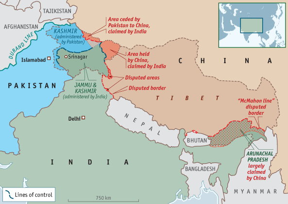
If You’re a Foreigner Using GPS In China, You Could Be a Spy
That's one of the geo-stories discussed over Slashdot over the weekend, If You're a Foreigner Using GPS In China, You Could Be a Spy. We mentioned China's restriction on foreigner mapping.
Their summary: "China has accused Coca Cola of espionage for its 'illegal mapping,' allegedly with the use of GPS 'devices with ultra high sensitivity.' On its face the case looks like yet another example of China's aggressive sensitivity about its maps, no doubt heightened by its ongoing fracas with the U.S. over cyberwar. Li Pengde, deputy director of the National Administration of Surveying, Mapping and Geoinformation, said during a radio interview on Tuesday that the Coca Cola case was only one of 21 similar cases involving companies using GPS devices in Yunnan to 'illegally obtain classified information.' According to Chinese authorities, geographical data can be used by guided missiles to strike key military facilities — a concern that one GPS expert says is overblown at a time when the U.S. government already has high-precision satellite maps of China. Nevertheless, Chinese law dictates that foreigners, be they companies or individuals, are prohibited from using highly-sensitive GPS equipment in China."