Supergeo Technologies, the global leading GIS software and solution provider, announced the cooperation with Suzhou FOIF Co. (FOIF) in providing worldwide surveyors with high accuracy GIS turnkey solution.
Mobile GIS is the base to establish GIS infrastructure with field data. And, data accuracy determines the quality and following processing time and cost. However, traditional survey instruments or post-processing usually cost a lot.
Having more than 50-year experience in geo-related surveying equipment manufacturing, FOIF presents gyroscope station, total stations, theodolites, laser products, GNSS and so on. By collaborating with FOIF, a reputed and professional hardware provider, Supergeo is able to provide users around the world with a complete GIS solution:
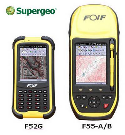
- Field Controller: F52and F55 Series Handheld devices
- Field Software: FOIF SuperGIS (with complete mobile GIS functions, plus NTRIPreal time correction solution)
- Office Software: FOIF SuperGIS-Desk
SuperGIS Desktop free trial
# # #
About Supergeo
Supergeo Technologies Inc. is a leading global provider of GIS software and solutions. Since the establishment, Supergeo has been dedicated to providing state-of-the-art geospatial technologies and comprehensive services for customers around the world. It is our vision to help users utilize geospatial technologies to create a better world.
Supergeo software and applications have been spread over the world to be the backbone of the world’s mapping and spatial analysis. Supergeo is the professional GIS vendor, providing GIS-related users with complete GIS solutions for desktop, mobile, server, and Internet platforms.