Over the last few months, we’ve been working hard to bring Fulcrum for iOS to the next level, making data collection even faster and more powerful. The app has been rebuilt from the ground up with tons of features and improvements all around, as well as a whole new refreshed look and feel.
What's new in 2.0
High Resolution Satellite Layer from Google

First up, we’ve added additional layers to give you access to high-resolution imagery data while in the field. Google’s Satellite and Hybrid views provide enormous levels of detail for places all over the world. Google’s expansive imagery database will give even rural and remote users access to quality imagery while on the go. The available imagery improves all the time.
Support for Overlay Layers
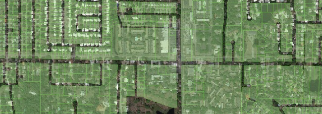
Upload overlay layers to use for reference while in the field. Datasets like parcel data, boundaries, routes, and other GIS layers can provide context and assistance for field data collection. These can now be added to the mobile app to view on top of imagery or other online layers. Building overlays is simple to do in TileMill, using one or a few GIS data layers (or raster layers). If you create a map with a transparent background, export to MBTiles format, and load into Fulcrum, the layer can be shown or hidden on top of the online basemap. This allows you to do things like build overlays of parcel data (like in the above screenshot), and overlay that onto the satellite imagery as a reference. Handy for all sorts of purposes.
Fullscreen Editing on iPad
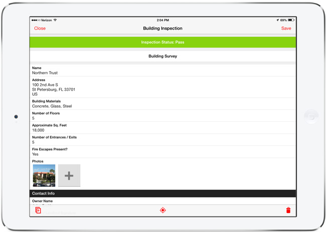
The form editing interface on the iPad has been modified to run in a full screen view, taking advantage of the larger tablet display for ease of use. This is gorgeous, and makes filling out detailed forms much easier, giving you more room for typing and data entry.
- Better Photo Settings - Control the size of photos to optimize upload speeds. You can now set low, medium, high, and full size native photo sizes to use with Fulcrum.
- Record search improvements - We’ve improved the search capability to navigate to data from the mobile app. Accessible right from the main screen, this will run a full-text search through the data on your mobile device.
- Filter data by project or status - Filters help to trim down the total records shown on the screen, speeding up access to the data you need to work on.
If you’ve already have Fulcrum on your device, the 2.0 version will show up as an update, or will automatically update if you have auto-update enabled in iOS 7. The 2.0 release of Fulcrum is a major improvement, and we’re looking forward to hearing how it helps improve field data collection needs with its new features and functionality.
Get the app from the iOS App Store.