colemanm

Fulcrum Adds Real-Time Data Publishing Features

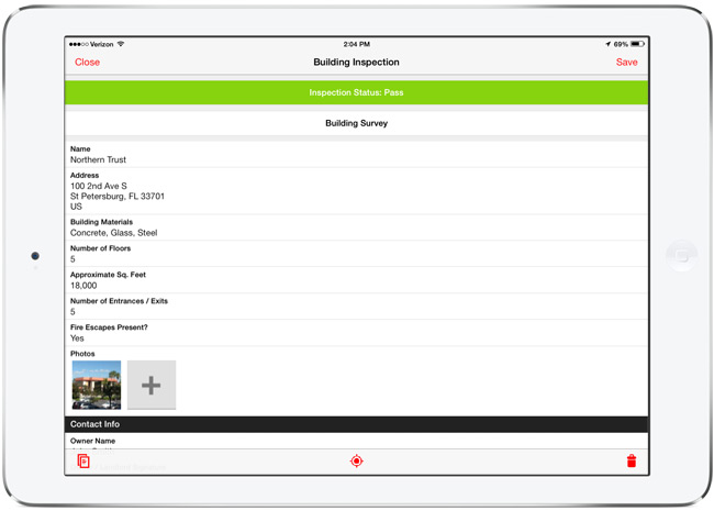
Many of Fulcrum’s users are in the field collecting data which later needs to be shared with various stakeholders, like clients, government agencies, or management team members. We recently released a feature that makes this process even easier. Data Shares allow you to generate simple URLs for downloading or accessing data within your Fulcrum Apps that you can publish or share.

Now, all users with Small plans and above have Data Shares available. An account’s owner can enable sharing for a specific App, and then have access to a URL that serves up that data in a variety of formats: CSV, KML, GeoJSON, or JSON. The owner can then give the link to, for example, a client. Each time the client accesses the link, they’ll pull up-to-date data from that App.

Being able to access your App’s data easily in multiple formats allows for sophisticated uses of that information in real-time.

Why This is Powerful

Data collection efforts are often continuous, with teams out in the field on a daily basis conducting inspections, user surveys, or field reports hour by hour, and syncing them to the cloud where the information can be visualized or exported. Many users export data as CSV on a recurring basis to analyze or merge with other data on their own systems. Now, once a data share has been enabled, you’ll be able to have their script use the URL to automatically fetch fresh data without running an export.

It’s powerful to visualize the data you collect, especially to quickly convey progress to stakeholders. Now it’s much easier to build a web map that uses current data each time the map is refreshed. You can use something like Bootleaf and a GeoJSON data share to easily display the data you’ve collected on a map. There are many parameters that can be used to customize the data returned to give a lot of flexibility and control.

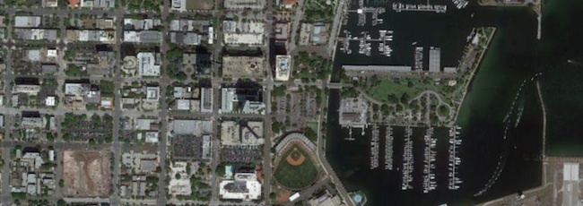
Other users may have used the Google Earth Streaming capability to quickly visualize the data they collect. But that shows data from all your Apps. Using a KML data share will allow this same, quick visualization scoped to just the App you want to share.

Using QGIS, the free and open source GIS software, you can even use a GeoJSON data share URL and add your live data to a QGIS map project using the data share URL. This is fantastic for getting a mappable layer into a GIS for combining with your other GIS data layers.

We hope these examples give you an idea of what else you can do with Data Shares and how valuable they’ll be to your efforts to use your data once collected.

About Fulcrum

Fulcrum is a mobile data collection platform built to allow users to design custom field survey form templates to deploy to mobile staff on iOS and Android devices. Since, Fulcrum has been helping organizations with mobile field staff save time and money, and collect better GIS information. Read more about Fulcrum by visiting the website, or follow us on Twitter or Facebook for updates.

Read More »

Fulcrum Mobile Data Collection: Version 2.0 for iOS

Over the last few months, we’ve been working hard to bring Fulcrum for iOS to the next level, making data collection even faster and more powerful. The app has been rebuilt from the ground up with tons of features and improvements all around, as well as a whole new refreshed look and feel.

What's new in 2.0


High Resolution Satellite Layer from Google

Satellite layer

First up, we’ve added additional layers to give you access to high-resolution imagery data while in the field. Google’s Satellite and Hybrid views provide enormous levels of detail for places all over the world. Google’s expansive imagery database will give even rural and remote users access to quality imagery while on the go. The available imagery improves all the time.

Support for Overlay Layers

Overlays

Upload overlay layers to use for reference while in the field. Datasets like parcel data, boundaries, routes, and other GIS layers can provide context and assistance for field data collection. These can now be added to the mobile app to view on top of imagery or other online layers. Building overlays is simple to do in TileMill, using one or a few GIS data layers (or raster layers). If you create a map with a transparent background, export to MBTiles format, and load into Fulcrum, the layer can be shown or hidden on top of the online basemap. This allows you to do things like build overlays of parcel data (like in the above screenshot), and overlay that onto the satellite imagery as a reference. Handy for all sorts of purposes.

Fullscreen Editing on iPad

Fullscreen iPad view

The form editing interface on the iPad has been modified to run in a full screen view, taking advantage of the larger tablet display for ease of use. This is gorgeous, and makes filling out detailed forms much easier, giving you more room for typing and data entry.

There are dozens of other small improvements all over in 2.0. Here are just a few highlights of other changes:
  • Better Photo Settings - Control the size of photos to optimize upload speeds. You can now set low, medium, high, and full size native photo sizes to use with Fulcrum.
  • Record search improvements - We’ve improved the search capability to navigate to data from the mobile app. Accessible right from the main screen, this will run a full-text search through the data on your mobile device.
  • Filter data by project or status - Filters help to trim down the total records shown on the screen, speeding up access to the data you need to work on.

If you’ve already have Fulcrum on your device, the 2.0 version will show up as an update, or will automatically update if you have auto-update enabled in iOS 7. The 2.0 release of Fulcrum is a major improvement, and we’re looking forward to hearing how it helps improve field data collection needs with its new features and functionality.

Get the app from the iOS App Store. 

Read More »