The popular open source geospatial data server GeoServer version 2.7 has been released earlier this week. The new features highlighted in the announcement: Color composition and color blending These are two new extensions to the rendering engine that allows for greater control over how overlapping layers in a map are merged together Relative time support in WMS/WCS WPS: WPS clustering ...
Read More »Alex
OpenLayers 3.4.0 Released
The popular open source web mapping library OpenLayers version 3.4.0 has been released today. Some new features according to the announcement: “Dateline wrapping has been added for tile sources, you can most clearly see this in the new wms-tiled-wrap-180 example. The draw interaction can now draw circles as well, check out the updated draw features example and select Geometry type Circle. […] ...
Read More »Crowdsource mapping assistance for cyclone-struck Vanuatu
The UN reports about Humanitarian Open Street Map Team (HOT) support of Cyclone Pam recovery in Vanuatu. HOT reported: “In the space of less than 24 hours, the HOT community more than doubled the amount of map data in OpenStreetMap. This was done by first covering all the priority islands to map with both Task Manager about 99% completed. The community ...
Read More »National Geographic’s Trails Illustrated Map Line To Be Available on Avenza’s PDF Maps App
Addition of Outdoor Recreation Maps Highlights Digital Options for Outdoor Enthusiasts on 100th Anniversary of National Geographic’s Cartographic Division TORONTO (March 17)—National Geographic Maps, celebrating 100 years as one of the most trusted names in cartography, will make available hundreds of maps from its Trails Illustrated line through Avenza Systems Inc.’s popular, award-winning PDF Maps app. The addition of ...
Read More »Blaze Terra users enjoy newest NASA data in form of 3D terrain web layer
16.03.15 - Eternix Ltd., leading provider of next-generation software for GIS visualization and editing in 3D, announces the addition of a new 30-meter global digital-terrain web layer to Blaze Terra’s collection of instantly accessible web layers, available as of version 4.1 of the software. The new web layer, derived from NASA’s Shuttle Radar Topography Mission (SRTM), depicts nearly the entire ...
Read More »pycsw Graduates OSGeo Incubation
OSGeo is pleased to announce that the pycsw project has graduated from incubation and is now a full fledged OSGeo project. Angelos Tzotsos, a long time member of the pycsw Project Steering Committee (PSC) has been appointed as project officer. The full post is available on the OSGeo website. The project powers numerous high profile activities such as US data/geoplatform, ...
Read More »Batch Geonews: QGIS News, GeoWave, New Google Roads API, Challenges of Geospatial Databases, and much more
Here’s the recent geonews in batch mode. From the open source / open data front: Beautiful progress and maps, The first ten years of OpenStreetMap, nice progress map, and somewhat related, Mapping turn restrictions and speed limits with Mapillary (crowdsourced Street Level photos ) A new open source database, GeoWave aims at linking popular geospatial tools to “big data” ...
Read More »QGIS 2.8 LTR Released
Releases of the popular open source desktop GIS software QGIS are always good news, and it is now at version QGIS 2.8 LTR. LTR what? “LTR stands for “Long Term Release”. This means that QGIS now has a system in place to provide a one-year stable release with backported bug fixes. The idea behind LTR is to have a stable ...
Read More »Steady Growth Spurs Getmapping’s New Recruitment
To support continued business growth, Aerial photography and mapping specialist Getmapping has made a number of new appointments to strengthen both its commercial and technical teams. Carl Greenman has joined Getmapping’s Business Innovation team as a Geospatial Specialist. He will be supporting projects across all areas of the Getmapping Group business, many of which require specialist GIS and geospatial skills, particularly the development ...
Read More »CubeWerx releases revolutionary new cloud platform for delivering imagery through Open Web Services
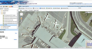
CubeWerx today announced the availability of OpenImgeMap™ – A cloud-based platform for hosting and publishing dynamic collections of geospatial imagery and securely delivering them through Open APIs. As a world leader in the provisioning of interoperable Web services, CubeWerx now sets the bar for dynamic hosting of imagery. Upload your data, tile it, and create Web services in minutes instead ...
Read More »