The pycsw team announces the release of pycsw 1.10.0.The 1.10.0 release brings significant features, enhancements and fixes to the codebase, including: support OGC OpenSearch Geo and Time Extensions standard support for Open Archives Initiative Protocol for Metadata Harvesting (OAI-PMH) support spatial dateline queries better support for geospatial links via the Python geolinks library fix CSW harvesting to harvest full records ...
Read More »Alex
Avenza® Releases Geographic Imager® 4.5 for Adobe® Photoshop®
Avenza® Releases Geographic Imager® 4.5 for Adobe® Photoshop® - Powerful geospatial add-on now compatible with Adobe Photoshop Creative Cloud™ - Toronto, ON, September 16, - Avenza Systems Inc., producers of MAPublisher® cartographic software for Adobe Illustrator® and the popular PDF Maps mobile app, is pleased to announce the release of Geographic Imager 4.5 for Adobe Photoshop. This latest ...
Read More »Earthdefine announces availability of high resolution land cover data for California
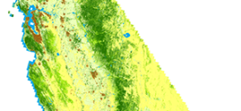
ISSAQUAH, Wash., September 9, - Earthdefine, a provider of high resolution spatial data products, has released the first high resolution land cover dataset for California. The California SpatialCover Land Cover product is based on aerial imagery and provides spatially explicit information at 1 meter resolution for six land cover classes - trees, impervious, bare, water, herbaceous, and shrubs. ...
Read More »FOSS4G: Live Stream, Birds of a Feather, Map Gallery, Parties - and more
September 5, Portland, Oregon, USA Live Stream, Birds of a Feather, Map Gallery, Parties - and more Updated schedule and conference live stream The schedule [1] has been updated with the latest details and is full of great workshops, presentations, and events. Take a look and start sketching out your conference now to ensure that you don’t miss any crucial ...
Read More »Explore the power of ArcGIS Geodatabase
The geodatabase is the common data storage and management framework for ArcGIS. It combines “geo” (spatial data) with “database” (data repository) to create a central data repository for spatial data storage and management. It can be leveraged in desktop, server, or mobile environments and allows users to store GIS data in a central location for easy access and management. Learning ...
Read More »Batch Geonews: OpenStreetMap Contributions, QGIS Cloud, Google ‘The Cartographer’, O’Reilly Book, and much more
Here’s the latest geonews in batch mode. On the open source / open data front: Ready for FOSS4G, the geospatial open source software collection named OSGeo-Live 8.0 has been released Pictures tell you everything, OpenStreetMap contributions around the world Informative charts, The OpenStreetMap Contributor Activity Report – Edition We mentioned QGIS Cloud two years ago, here’s an entry ...
Read More »Profit Tools to attend the annual IANA Intermodal Expo in Long Beach
Lee NH, August, 27 — Profit Tools, the innovative leader in Intermodal software solutions will be attending the IANA Intermodal EXPO, September 21-23 at the Long Beach Convention Center in Long Beach, California. In addition to unveiling new products, Profit Tools will be demonstrating its track and trace container software. This innovative software allows users to avoid going ...
Read More »OpenLayers 3.0 Released
This is major news. The open source OpenLayers library is one of the most widely used web mapping software. After a complete overhaul of the venerable 2.x branch, OpenLayers 3.0 has been released. From the announcement: “This release includes a ton of new features such as an easier to use API as well as improved vector rendering and image manipulation. […] ...
Read More »Batch Geonews: Google Drone Delivery, Galileo Satellites Failures, 100 New 3D Cities for Bing Maps, 1M NYC Buildings in OSM, and much more
Here’s the recent geonews in batch mode. On the open source / open data front: A webinar Friday next week named Introducing the QGIS Academy Project Nice to see, Over 1 million New York City buildings and addresses imported to OpenStreetMap Because that’s the kind of maps we want to show our friends, Showing geotagged photos on a Leaflet map ...
Read More »Convert PDF to dwg format on your iPad or iPhone for free
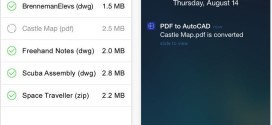
Working on the go is growing in popularity, as today’s mobile devices are becoming increasingly powerful. Today one can manage all email conversations, perform meetings or create reports while being out of office, from a mobile device. While complex work still requires being in the office in front of a computer, urgent edits and drawings can be done from our ...
Read More »