Tag Archives: iOS

Batch Geonews: 89% Use Google Maps, New Google Maps UI and iPad app Available, Esri UC Round Up, and much more

Here's the recent geonews in batch mode. Several interesting bits in there that may have deserved a full entry, but it's Summer time and I'm on holidays :-)

On the open source / open data front:

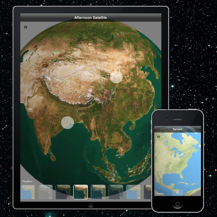
  • Remember Maki, the open / free cartography symbols? Maki got significantly improved and even gets an API
  • Announced, OpenGeo dives deeper into QGIS, along with the OpenGeo Suite 3.1 release
  • Jody shares his experience on OSGeo and LocationTech software foundations and their different cultures
  • Getting closer, OpenLayers 3.0.0-alpha.3
  • A success story in the Netherlands, Open standards open source projects for sharing geodata among provinces saves €4.5 million
  • A book review of 'Interactive Map designs with Leaflet JS Library How-to' by Jonathan Derrough

On the Esri front:

  • Lots of Esri news in the Round Up of Directions Magazine Esri UC Coverage 
  • A popular template, Map Tour story map template updates
  • James goes on with ArcGIS for Minecraft this time
  • Overview for Using the power of Amazon EC2 to build ArcGIS Server map caches

On the Google front:

  • Bang! 89% of websites that use mapping technologies use Google, while that may not be the exact figure, it does mean something
  • The new Google Maps interface is available to all, but you still have to opt-in, it's *really* an improvement
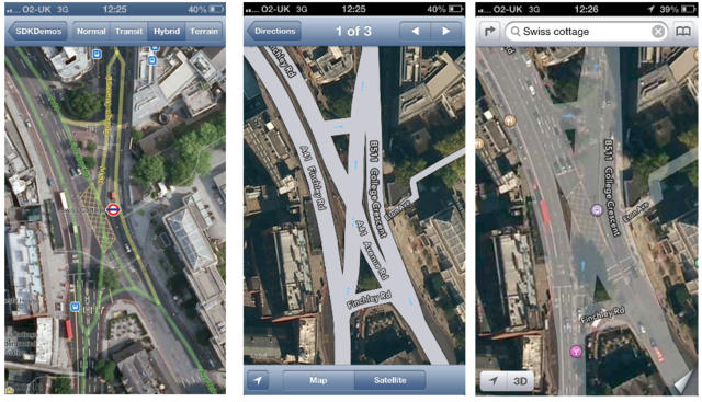
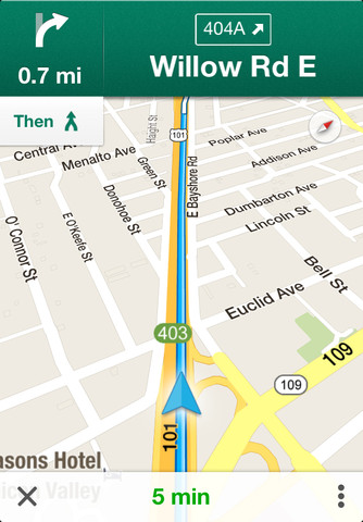
  • I'm amongst the happy ones, The new Google Maps app for iPhone and iPad is here
  • This goes along with the SDK version 1.4, Street View, indoor maps, and an updated map design in the Google Maps SDK for iOS
  • Jumping in, Google joins LocationTech
  • Indoor mapping everywhere, Where are we going to eat? See inside before you decide!
  • New places, On top of Mt. Fuji with the Street View Trekker and Scaling the heights of the Eiffel Tower
  • Still on a parallel track of OpenStreetMap, Growing the Google Map Maker community in Europe
  • And today, there is new imagery again

Geonews discussed over Slashdot:

  • Cheer up, Spatial Ability a Predictor of Creativity In Science
  • Another one, Disney Algorithm Builds High-Res 3D Models From Ordinary Photos
  • 3D printing for the masses, eBay Dips Toes Into 3-D Printing Market With iOS App
  • In case your weren't certain, U.S. DOJ: We Don't Need a Warrant To Track You
  • If you have a car, you can be tracked, "Smart Plates" Could Betray California Drivers' Privacy
  • And why not, ACLU Study Says Police Cameras Create Database of Our Movements
  • But some good news, Texas School District Drops Embattled RFID Student IDs; Opts For Cameras
  • Unsurprisingly, New Android Eyewear Wants To Compete With Google Glass
  • We mentioned what3words before, and now over Slashdot, Describe Any Location On Earth In 3 Words
  • What's in an Interactive Nukemap, Now In 3D

In the miscellaneous category:

  • Exposing online devices, Shodan lets you search and find the physical locations of online devices
  • On Apple, Apple Acquires Locationary to Address Location-based Big Data and Acquires HopStop for public transit  ... and according to Slate,  Apple's Maps Strategy Is Working Just Fine
  • An interesting discussion on mapping millions of dots and making great maps out of it
  • Via OR, an architecture book and design book named Operative Design: A catalogue of spatial verbs
  • OR shares a interesting quote: "We’re all carrying little networked laboratories in our pockets. You see a photo. I see millions of light-sensor readings at an exact coordinate on the earth’s surface with a time resolution down to the millisecond. The future is combining all these signals into new ways of understanding the world, like this real-time stream of atmospheric measurements."
  • BIM is there to stay? 71% of AEC professionals in annual UK survey see BIM as the future and Widespread adoption of BIM by national governments

In the maps category:

  • This was a hot topic in the U.S. recently, Mapping the Trayvon Martin murder case
  • Maps of Global Patterns of Tobacco-Related Economic Issues and another one on tobacco consumption
  • O'Reilly shares an Interactive map: bike movements in New York City and Washington, D.C.
Read More »

Google Geonews: Cloudless Imagery in Maps and Earth, New Google Earth 7.1 for Mobile with Street View, 50 New Cities in 3D, and more

Here's the recent Google-related geonews.

From official sources:

  • Excellent news, there's now only clear skies on Google Maps and Earth, cloudless imagery at least in the northern hemisphere to start with
  • Google Earth 7.1 for Android and iOS was released and now features Street View imagery
  • You can now apply to get the Street View Trekker kit to contribute to Google Maps, also discussed over Slashdot
  • Here's the new list of supported browsers for JavaScript Maps API v3, that list was last updated 3 years ago!
  • Google Maps additions:
    • Japan's Battleship Island in now featured in Google Maps, discussed over Slashdot
    • Fans of Thomas Jefferson, there are now Street View images of Monticello’s grounds and some building interiors in Google Maps
    • Dubai's Burj Khalifa, the world's tallest skyscraper, is now in Street View

From other sources:

  • The GEB reports a quiet major update to Street View and 3D imagery, with 3D imagery in 50 news cities
  • Here's the Tour de France in Google Earth on Android
  • Also interesting is the exploration of 25,000 ancient sites in Google Earth with the Megalithic Portal
  • Kurt shows coastal erosion rates in the entry Google TimeLapse for coastal and marine applications
Read More »

Supergeo Provides SuperGIS Server Mobile SDK Samples

Supergeo Technologies, the leading global provider of complete GIS software and solutions, provides SuperGIS Server Mobile SDK samples through instruction text, sample code, video, etc. to assist developers in comprehending the usage of SDK.


The new-launched SuperGIS Server 3.1a offers Value and Standard editions to your requirements in diverse projects. The Value edition supports to publish map services, feature services and basic geoprocessing services. Not only serving all functions offered by Value edition, the Standard edition also performs advanced geoprocessing services and Mobile SDK which enables users to customize their mobile applications to access SuperGIS Server services.


The Mobile SDK Samples supports iOS, Windows Mobile, Android platforms. Supergeo provides Windows Mobile users specifically with a sample, demonstrating how to develop an application to access SuperGIS Server services, directly edit features directly, and enable simultaneous editing by multiple users via the Internet.

#  #  #

About Supergeo


Supergeo Technologies Inc. is a leading global provider of GIS software and solutions. Since the establishment, Supergeo has been dedicated to providing state-of-the-art geospatial technologies and comprehensive services for customers around the world. It is our vision to help users utilize geospatial technologies to create a better world.


Supergeo software and applications have been spread over the world to be the backbone of the world’s mapping and spatial analysis. Supergeo is the professional GIS vendor, providing GIS-related users with complete GIS solutions for desktop, mobile, server, and Internet platforms.

Read More »

Launch of the Open Source ‘MapBox Earth’ for iOS

MapBox announced their open source iOS virtual globe named MapBox Earth.

From the announcement: "We just launched MapBox Earth, a free and open source iOS app that combines the power of a 3D globe with MapBox’s beautiful maps. It’s also a great starting point to build your own 3D mapping app - we’re cracking the 3D globe software market wide open by releasing the source code and building in the open. MapBox Earth is a universal app optimized for iPhone and iPad and it includes beautiful preloaded layers based off of MapBox Streets, MapBox Terrain, and MapBox Satellite. You can switch the map layer with a single tap and feel the maps right in your hands, in gorgeous and fast 3D."

We did mention some other open source virtual globes in the past months / years, such as Glob3 Mobile, the Godzi WebGL Globe, OpenWebGlobe, WebGL Earth, and there's even the Google open source 'WebGL Globe'.

Read More »

Batch Geonews: Bing Maps in AutoCAD, iOS Geofences, GitHub for GIS, TeachGIS, and much more

Here's the recent geonews in batch mode.

On the Apple front:

  • iOS's Find My Friends Gains Customizable Geofences, letting you know when friends are nearby or warning you when kids arrive at home
  • Catching up, Apple Expands 'Maps Ground Truth' Hiring to Rest of the World
  • Japan? Apple Releases iOS 6.1.3 With Japanese Maps Enhancements

In the everything else category:

  • Another interesting entry from Brian Timoney, Your Online Map Is Missing Half Its Audience: More Revealing Web Analytics From the Field
  • An interesting short entry on the future of Esri, LA Times Travel Section Interview with Jack Dangermond
  • Some of you will be interested in the Ten Things GIS Users Need to Know about GitHub
  • Via OR, that's remote sensing, Millimetre-Accuracy 3D Imaging From 1km Away
  • Here's an entry on How NASA uses Google Earth
  • A new website, TeachGIS: Resources for and by GIS Instructors
  • OpenStreetMap's iD editor gets drag and drop GPX support
  • If you do surveying Kurt invites us to look at Trey's TrailScribe
  • Interesting, Neighborhoods are Just Predefined Geofences
  • To be honest, I did not know who was John Snow, Lessons from the ghost of John Snow: "demonstrating one of the first applications of spatial analysis to detect the cholera outbreak in London in 1854"
  • The Economist shares an article on MapBox's web mapping offers
  • A Slashdot discussion on How To Stay Ahead of Phone Tracking ?
  • Another from the same source, virtual reality? USC Launches 3-D Printed VR Headset Library
  • An O'Reilly article on the use of sensors for news reporting
  • Stamen teams up with Nokia to show their HERE 3D data
  • Bentley is doing well, summary at Bentley Annual Update
  • Wonder about Autodesk? Autodesk Rebrands and Launches InfraWorks for Civil Design
  • Forcing geospatial knowledge into workers, U.S. DOT To Require GPS Training for New Commercial Truckers

In the maps category:

  • GeoCurrent offers many new informative maps:
    • Maps of Global alcohol consumption
    • Maps of Global Geography of Meat (and Fish) Consumption
    • Maps of cheese production and consumption
    • And why not, the Global Geography of Milk Consumption and Lactose (In)Tolerance
    • On Egypt and the World Diesel Price Map
    • A Map of The Countries That Are Most and Least Welcoming to Foreigners
  • Via APB, 28,000 rivers wiped off the map of China
  • Here's a funny map of all subways of North America
  • As a bonus for reading up to here, you have to see this remote sensing 1-minute video of the Arctic / Beaufort Sea February-March 1000-km ice fracture: "While fracturing events are common, few events sprawl across such a large area or produce cracks as long and wide as those seen here." Look at a map of North Alaska first to understand the scope of this.
Read More »

An In-Depth Comparison Between iOS Map Frameworks: Apple MapKit vs. Google Maps SDK

MacRumors summarizes a full entry on an In-Depth Comparison Between iOS Map Frameworks: Apple MapKit vs. Google Maps SDK. Really an informative article, go read it.

From the comparison: "The Google Maps for iOS SDK isn’t all roses, however. McKinlay warns that Google applies usage limits and quotas to their Places Search API, so if your app gets too successful then you get “punished” for it. [...]  There were a few reasons we chose to implement a dual mapping solution. The first was where we couldn’t do everything we needed on the Google Maps so had to keep Apple Maps, otherwise we would be removing features from our app (such as advanced overlays and gradient polylines)! [...]  However, Armstrong adds that MapKit only wins for now: “Ask again in six months’ time and that opinion may have changed.”" 

Read More »

Google Maps for iOS Receives First Update, Version 1.1

I guess this would normally not be major news, but since a lot of iPhone users rely on it and that alternatives like Apple Maps and Blackberry Maps have not impressed the press so far, here it is: Google Maps for iOS version 1.1 has been released, but no iPad compatibility yet.

MacRumors informs about it: "What's New in Version 1.1:

  • Search your Google Contacts; sign in to have your saved addresses show up when you search for friends and family by name.
  • Quickly search for local places by selecting popular categories such as restaurants, bars, cafes, gas stations, etc.
  • Choose between Kilometers or Miles for your preferred distance units.
  • Note that some features may not be available in all countries."

Read More »

Google Geonews: New 3D Imagery for Cities, Mapping Meteo Impacts, Google Earth for Research Book, Multiplayer Games, and more

I have a lot of geonews to catchup. You'll get everything that's pertinent (at least from my point of view ;-), but just a bit later than usual. Thanks for your patience!

Here's the recent Google-related geonews. Nothing major, but several interesting items.

From official sources:

  • The first update to the Google Maps SDK for iOS
  • Google informs us that Ski Resorts are now on Google Maps

From other sources:

  • The GEB informs us that Google released 3D imagery in Berne (Switzerland), Anaheim (California) and other cities around the world
  • Ogle Earth has an entry named Reconstructing the Chelyabinsk meteor’s path, with Google Earth, YouTube and high-school math
  • Related, the GEB has an entry named Mapping meteor impacts
  • Still the same source a book named "Google Earth and Virtual Visualizations in Geoscience Education and Research"
  • The GEB shares a kmz to watch U.S. watersheds in Google Earth
  • The GEB reminds us that we can animate GPS tracks in Google Earth
  • You're an Olympics fan? Previewing the Winter Olympics in Sochi
  • If you prefer Grand Prix racing, Ride along GP tracks from all over the world
  • There has been games for Google Earth for a while, but now we're talking about multiplayer games: Two player driving shooter game in Google Earth
Read More »

Batch Geonews: Voxel.js Minecraft-like, QGIS for Android, Side-by-Side Router, and much more

Here's the recent geonews in batch mode.

On the open source front:

  • 3D and open source with WebGL mixed with games gives you Voxel.js: Minecraft-like Browser-Based Games, But Open Source, which can certainly be reused for other geospatial projects
  • Never mentioned here before, an QGIS for Android in development, and on a similar topic, QGIS Globe works again
  • OpenStreetMap's new editor named iD gets a new home and updates, ideditor
  • After last year's success, NASA launches second International Space Apps Challenge, open data and open source
  • MapBox-related news:
    • Of course, MapBox Maps Now Embed On Twitter
    • You can now embed MapBox interactive maps in Apple iBooks Author software
    • An entry on Using Google Fusion Tables to Add Real-Time Feeds to MapBox Maps

On the Esri front:

  • The ArcGIS Online World Topographic Map first updates

On the Google front:

  • A nice Side-by-Side Router, allowing you to see directions for driving, transit, bicycling and walking on a same map
  • You can learn a bit more, Details of Google's Project Glass Revealed In FCC Report

In the miscellaneous category:

  • Microsoft shares a Bing Maps for Windows Store Apps Training Kit
  • And if developing for iOS, Apple Reaches Out to LBS Developers with iOS 6.1 POI Search API
  • Pretty interesting on the future of 3D photography, Light Field Photography Is the New Path To 3-D
  • Not the first time we hear about similar protections, In Brazil, Trees To Call For Help If Illegally Felled
  • Satellites (including footprints) and iPad / iPhone: New iOS app to view the SES Astra satellite info
  • I did not know that February 2nd is World Wetlands Day
  • Interesting on the Future U.S. Workforce for Geospatial Intelligence, the world needs need more geospatial experts
  • Which is also true considering 95% of of Public Safety Agencies Under-utilize Computer Mapping and GIS
  • A topic we discussed recently, Analytics for people, the next big thing in retail
  • If you have an interest in check-ins, 500 Million Foursquare Check-ins Visualized

In the maps category:

  • A different kind of map, Swiss Historical Maps Allow Journey Through Time In Your Browser
  • Map of the Geography of Abortion Access in the US
  • On the geography of languages, here's entries named World Maps of Language Families, World Maps of Language Families, Continued, and Remaining Language Families and Geographical Language Groups
  • Let's close this batch mode edition by another funny xkcd on mapping

Read More »

National Geographic Maps Now Available on Avenza’s PDF Maps App

Alliance provides new platform to access more than 500 National Geographic maps via Avenza’s database

TORONTO (January 28) – National Geographic Maps, one of the most trusted names in cartography for nearly 100 years, has joined with Avenza Systems Inc. to offer a new channel to access its rich map content. The alliance enhances Avenza’s digital map database by adding more than 500 maps from National Geographic, a world-renowned source, and furthers National Geographic Maps’ established reach with mobile consumers.

The Avenza PDF Maps app takes advantage of geospatial technology and allows travelers, recreationists and map lovers to view, acquire and interact with maps on their mobile devices, including iPhone and iPad, without worrying about data accessibility and international roaming charges. In addition, PDF Maps offers an in-app store to facilitate the transaction and delivery of those maps, consolidating, in a digital format, consumers’ access to hundreds of maps from multiple publishers.

“In the last decade, advances in technology have shifted how consumers receive and use information, and we have responded by making our rich map content available on a variety of platforms,” said Charles Regan, senior vice president and general manager, National Geographic Maps. “Avenza’s PDF Maps app provides a unique way for consumers to access our content with an easy-to-use in-app map store and a set of robust features that will enhance the map user’s experience.”

Hundreds of maps from National Geographic Maps’ extensive library are now available in Avenza’s PDF Maps system, including popular travel and destination titles covering five continents, historical and thematic maps, and educational and reference titles. The app provides constant access to geographic information and points of interest, with additional interactive tools such as measuring, place marking and location tagging. PDF Maps operates without the risk of lost reception, due to cell tower proximity – making it the ultimate traveling tool, as it does not rely on an Internet connection.

“Avenza PDF Maps provides the ability for anyone to share map-related information by documenting locations with customized notes, photos and descriptions,” said Ted Florence, president of Avenza Systems Inc. “This expands the utility of a map beyond location guidance, as it is also a tool to share experiences and locales with notes and photos. We continue to strengthen our community of map publishers and further advance the mapping tools consumers demand, and we look forward to seeing how the industry evolves in a digital age.”

PDF Maps is available now on the iTunes App Store free of charge for personal use. National Geographic maps can be accessed via the PDF Maps in-app store. For more information about the app, visit the Avenza PDF Maps website or Avenza’s main website. Pricing of each map is set by the publisher, and free maps remain free to users through the PDF Maps in-app map store.

About National Geographic Maps

National Geographic Maps was established as a division of the National Geographic Society in 1915 and has been producing maps for National Geographic magazine and other Society media for nearly 100 years. National Geographic Maps publishes wall maps, outdoor recreation maps, travel maps, interactive maps, atlases and globes that inspire people to care about and explore their world.

About Avenza Systems Inc.

Avenza Systems Inc. is an award-winning, privately held corporation that provides cartographers and GIS professionals with powerful software tools for making better maps as well as the PDF Maps mobile mapping system. In addition to software offerings for Mac and Windows users, Avenza offers value-added data sets, product training and consulting services.

Read More »