Tag Archives: OpenStreetMap

Saturday Geonews: TileMill 0.4.1, Esri FileGeodatabase API 1.1, GIS with Google Earth, Layar Vision App, and much more

Here's the recent geonews in batch mode. Yes, on a Saturday! I'll be away for the next three weeks and dare delay my family's departure to feed you with these.

From the open source front:

  • Mentioned before, the open source map design tool TileMill reached version 0.4.1   
  • Some recent improvements of QGIS: an extraction projection tool for QGIS, a new MapInfo to QGIS style converter and Shield Labels for QGIS
  • Not the first time it happened, a briton got arrested during his OpenStreetMap mapping activities, yes, that was before the recent London riots
  • O'Reilly offers an entry named Open source maps tell data journalism stories in Afghanistan
  • Paul Ramsey of the PostGIS fame shares interesting arguments on the open source vs proprietary debacle
  • Here's an entry on generating elevation maps from along-track stereo pairs using the open source Orfeo ToolBox
  • We told you ourselves a few times, but here's how James Fee telling us Why You Can’t Afford to Miss FOSS4G

From the Esri front:

  • The File GeoDatabase API version 1.1 has been released, in includes a .NET wrapper and bug fixes
  • James Fee mentions PgMap and QMap to connect to spatial databases with ArcGIS 10.1 without SDE

From the Google front:

  • In their learning series, here's an entry on GIS with Google Earth and Google Maps
  • Google shares an entry on famine crisis relief in the Horn of Africa
  • Here's the 50th anniversary of the building of the Berlin Wall in Google Earth
  • Google invites us to visit the Hiroshima Peace Memorial with Google Maps

On the Microsoft front:

  • Microsoft updated their Bing Maps Account Center with three main improvements: Direct Publishing of Data Sources, Map Navigation for Data Editing, and Enhanced POI Data Search
  • Here's an entry named KinectFusion Provides Low-Cost and Accessible 3D Interior Mapping

In the miscellaneous category:

  • The Spatial Law blog shares a long entry named Geolocation and Privacy: Are We Going the Right Way?: "However, many of bills are so broadly written that if they were to become law they could apply to a broad range of geospatial products and services, including satellite and aerial imagery, GIS and GPS."
  • VerySpatial mentions the launch of the augmented reality Layar Vision app to "recognize real-world objects and then trigger digital content based on that object"
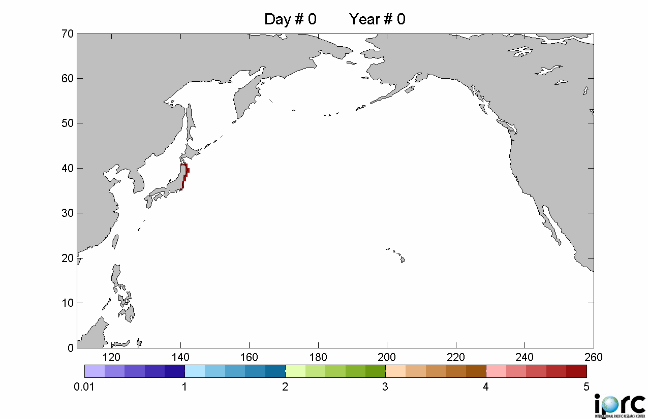
  • The GEB shares satellite imagery on the Japanese Tsunami that created some massive icebergs
  • MacRumors details an Apple patent on schematic maps: "[...] a new maps application that could display a simplified subset of information most relevant to a user seeking specific information or routing."
  • In special remote sensing news, Slashdot mentions a camera reaching its target by being thrown by a grenade launcher
  • MapQuest tells us how free listing works on their MapQuest Local Business Center

In the maps category:

  • O'Reilly discuss maps of the recent London riots
  • Mapperz mentions the release of USGS historical maps
Read More »

Slashgeo Now Media Partner of the State of the Map Conference

I'm glad to announce Slashgeo will be a media partner with the State of the Map conference.

"The State of the Map is the world’s leading OpenStreetMap community event. Join participants from all around the world in Denver, Colorado, USA from September 9th – 11th to hear talks, participate in workshops and hang out with OpenStreetMappers from around the world. If you are involved with any aspect of OpenStreetMap from mapping to coding to campaigning, or if you want to hear more from the global mapping movement that is changing the way maps are made and used, the State of the Map is for you!"

Today's importance of OpenStreetMap has been demonstrated numerous times, to the extent that MapQuest is using OpenStreetMap and Microsoft too, they even hired OpenStreetMap's founder. Only Google resists for the time being, probably because they favor Google Map Maker. Slashgeo mentioned OpenStreetMap hundreds of times in the past 6 years.

The State of the Map conference takes place just before FOSS4G, where Slashgeo will also have an editor on the site.

Read More »

Thursday Geonews: Bing Maps Map Style Updated, London Transit in Google Maps, Timezones Shapefile, Backseat Driver, and much more

Here's the recent geonews in batch mode covering the last two weeks. It's a bit longer than usual.

On the open source front:

  • Almost two weeks ago, the OSGeo released their 2 minutes video promoting the FOSS4G conference, Slashgeo is proud to be a media partner
  • The FGT blog offers a long entry on the portable version of gvSIG, an open source GIS - portable meaning running from a USB key with a host computer with no intallation required
  • Several sources mentioned that Canada's British Columbia opened their province-wide open data portal, with plenty of geospatial data in it
  • While we mentioned the its preview in May, here's more documentation on the upcoming GeoRepository, an advanced authorization manager for GeoServer
  • ImageI/O-Ext 1.1.1 has been released
  • uDig 1.2.2 has been released too
  • There's a PostGIS Drupal module in the works

On the Google front (well, new since yesterday):

  • Public transport directions of London is now available in Google Maps
  • Google details the new Google Maps version 5.8 for Android, adding photo uploads and My Places
  • Mapperz tells us how to load OpenStreetMap data in Google Earth via FME with BBOX.ME

On the Microsoft front:

  • Most visible changes for users are updates to the Bing Maps road map style, they even offer a 9-pages guide to detail what 's new
  • APB reports that Microsoft will use Gigwalk to enhance Bing Maps search results
  • Microsoft announced Bing Maps updates to Account Center, REST Services, and Documentation
  • Another entry enumerate what's new in the Bing AJAX Map Control

In the miscellaneous category:

  • O'Reilly links to a free shapefile of the TZ timezones of the world
  • SS mentions the GeoTime software that "displays movement over time in an intuitive manner"
  • Here's an article on the technical, scientific, historic and political background to the GPS system
  • On the topic of the future of GPS, V1 shares an entry named the Significance of LightSquared Debate to Europeans and APB shares ESA's reaction to LightSquared potential interference with Galileo
  • MacRumors have an entry named Apple Pays $946 in Korean Lawsuit Over Location Data Collection, New Class Action Suit Coming
  • In the funny category, APB mentions (video included) ToyToyota's Backseat Driver GPS iOS game for kids that uses the real-time itinerary of the car

Discussed over Slashdot:

  • 3D Hurts Your Eyes
  • Chief NSA Lawyer Hints That NSA May Be Tracking US Citizens
  • Google Grabbed Locations of Phones, PCs
  • Undersea Cable Map Shows Where The Data Pipes Are

In the maps category:

  • SS shares an entry named eLEAF Maps the World’s Water for Food Security
  • Ready for the hurricane season, the UK Met Office launched their Storm Tracker (beta), with free and paid versions, and on the same topic, the GEB offers an entry on tracking hurricanes in Google Earth
  • V1 mentions Africover WebMap from the UN, offering geodata for Africa
  • O'Reilly have an entry on cellphone connections in the U.S.
Read More »

Tuesday Geonews: South Sudan Maps, LightSquared GPS Debacle Update, Historical Photos in StreetView, ERS-2 Retired, and much more

Here's the recent geonews in batch mode, covering almost two weeks worth of geonews. I'm voluntarily leaving Esri-related geonews out for an upcoming entry specifically on their user conference.

On the open source front:

  • Geomajas 1.9.0 has been released, along with 10 plugins (2 of them new) - here's what is Geomajas
  • Here's instructions to load OpenStreetMap data in QGIS
  • Here's a comparison of browser windows of QGIS and MapInfo 11
  • We mentioned quite a few times the OpenLayers 2.10 Beginner's Guide, and here's another review of it

On the Google front:

  • Google mentions Historypin now being available worldwide, in which historical photographs are overlayed on Google's StreetView or directly pinned in Google Maps
  • Google shared an entry on using Street View to digitally archive Japan’s disaster zones
  • Here's tutorial and documentation on the Google Places API
  • Here's an entry on Google Map Maker in Pakistan
  • Here's the world's longest bridge over water, now open and in Google Earth
  • In the trivia category, Slashdot discussed Tilting Bike Uses Google Maps To Simulate Routes

On the Microsoft front:

  • Bing Maps got a new user interface (screenshots included)

In the miscellaneous category:

  • The FGT blog offers a long and informative update on LightSquared jeopardizing GPS signals in the U.S.
  • The FGT blog also mentions the 'Earth Survey Plugin' showing National Geodetic Survey control points near a specific area and much more
  • Two weeks ago VerySpatial shared an interesting entry named Cloud Computing Speeds Up And Simplifies the Adoption of Spatial Technology
  • The Map Room recommends an old article named Global Impositioning Systems: Is GPS technology actually harming our sense of direction?
  • APB mentions Locata, a company offering high-accuracy radio-location technology for where GPS isn't available
  • MapTogether links to a The Economist article on gerrymandering and election boundaries in the U.S.
  • Ogle Earth informs us that India eased its remote sensing data policy to allow resolutions of up to 1 meter
  • Slashdot discussed the story named Geocaching Shuts Down British Town, because of a bomb scare
  • The venerable ERS-2 launched in 1995 is getting retired

In the maps category:

  • Ogle Earth has an entry on the recently-born South Sudan and its maps and geography
  • Slashdot discussed a story named Construction of ESA Galaxy Mapping Satellite Completed
  • Here's an entry on mapping the world's sea turtles
Read More »

Wednesday Geonews: The End of Yahoo! Maps APIs, Magicshop Frontdoor, MapInfo 11 News, Israel Imagery, and much more

Here's the geonews in batch mode, covering a bit more than a week (exception made of a few minor geonews I forgot to mention in our last 'batch mode' edition). On the open source / data front:

  • A new MapGuide Instant Setup utility has been introduced
  • Here's a detailed entry on scale-dependent generalization in PostGIS and QGIS
  • Here's an entry on time and elevation support in GeoServer
  • If you're new to OpenStreetMap or want to introduce new people, here's OpenStreetMap editing for beginners videos
  • Plenty geoblogs mentioned the Magicshop Frontdoor (Beta) tool, with which you can easily improve address search results for Bing Maps and OpenStreetMap
On the Google front:
  • Ogle Earth mentions Google JV applied for online mapping license in China
  • Ogle Earth also mentions the constraints on high-resolution satellite imagery of Israel in Google Earth/Maps
  • There's New Building Maker cities available in Argentina and Canada
  • Google unveiled the new My Places tab on Google Maps, "which helps you quickly view and interact with your saved maps, starred locations, and rated businesses"
  • They also introduced descriptive terms in Local Search results
  • The GEB mentions the Touristo and Skydiver games for Google Earth
  • Some readers like to know when there's new imagery available in Google Earth, well, there is 
On the Microsoft front:
  • An entry on The Value of Bing Maps Spatial Data Services
In the miscellaneous category:
  • Mapperz informs us of the Yahoo! Maps APIs Service Closure, due 13th September     
  • James Fee summarizes What Was Up at the Pitney Bowes Business Insights Conference, with news of MapInfo 11, and APB has more on MapInfo Spatial Server
  • APB shares a long article named Intergraph and ERDAS: From GeoMedia to IMAGINE-The Big and Little Picture for this Geospatial Marriage, Spatial Sustain also shares an entry on the same topic, named Intergraph ‘Reinforces the House’ Under Hexagon
  • A study concludes that Schematic Transit Maps Affect Passengers' Travel Choices
  • Slashdot discussed a story named New Projects Use Phone Data To Track Big Cities' Mass Transit Use
  • Slashdot also offers a story named NASA's Aquarius Launched To Help Map the Oceans' Salt
  • Still from the same site, we learn the Nissan LEAF Leaks Speed & Location To RSS Feed
  • And last story from that site, if you're interested in tools to map wifi networks, this discussion named What's Killing Your Wi-Fi? will interest you
In the maps category:
  • The Strange Maps blog offers maps of the U.S. States, with what they do best and worse, worth a quick look of you're American
  • Slashdot mentions a map of the Universe called the 2MASS Redshift Survey
  • Not a geographic map, but O'Reilly has an article on generating a map of your LinkedIn contacts with InMaps, I found the result pretty interesting
Read More »

What’s the best iOS App for contributing to OpenStreetMap?

I asked the OpenStreetMap LinkedIn group this question but did not get any satisfying answer, so I'm trying with the thousands of Slashgeo users now :-) "On the OSM wiki, there's quite a few iOS Apps listed, but a lot of them don't focus on contributing to OSM and many of them do not seem to be in active development. Thus my question: what's the best iOS App for contributing to OSM according to you? It's for an iPad 2 [with GPS]. Thanks!"

Read More »

Open Source / Data Geonews: MapGuide 2.2, GeoRepository and GeoServer-Manager, OpenStreetMap News, and more

Here's the recent geospatial open source / data news for the last 8 days or so. On geospatial open source:

  • The Autodesk-supported web mapping software MapGuide Open Source 2.2 was released
  • Here's a preview of GeoRepository, and advanced authorization manager for GeoServer and the new GeoServer-Manager, a simple Java client library for GeoServer
  • OpenGeo introduced the OpenGeo Gallery, to answer the question 'who uses the open source software that OpenGeo supports'
  • There's the first release of Image Georeferencing View for uDig 1.2.1
  • GeoTools has a new User Guide and so does Sextante GIS
  • Shapely 1.2.10 has been released
On open geospatial data, mostly OpenStreetMap:
  • We mentioned the book last September, and now Geoweb Guru offers a review of the book 'OpenStreetMap: Using and Enhancing the Free Map of the World'. From the review: "Due to the overview nature of a wide range of different applications and projects, it is likely that quite a bit of the book will become out of date quite quickly. It is also likely that the data model will evolve."
  • Here's an entry on directions (and correcting erroneous routing behavior) with OpenStreetMap
  • Spatial Sustain shares a perspective asking Is Open Location the Next Open?
  • Here's a screenshot of JOSM on a tablet
Read More »

Monday Geonews: Finding Osama Bin Laden in Google Earth, FOSS4G News, More on ‘Locationgate’, and much more

Here's the recent geonews in batch mode. Some of those news could have deserved individual announcements. From the open source / open date front:

  • Regarding the FOSS4G conference, the community can now vote to determine the program of the FOSS4G conference, and there will be an Introduction to Geospatial Open Source day-long event
  • The final version of MapGuide Maestro 3.0 has been announced
  • OpenStreetMap has been recognized by the United Nations Foundation
  • OpenStreetMap data can be used in the X-Plane flight simulator
  • GeoTools 8.0-M0 has been released
  • Here's a new review of the PostGIS in action book, which is now available on Amazon: [amazon 1935182269]
  • Talking about books, here's the new Locate Press, focussing on publishing on open source geospatial projects
  • O'Reilly offered and article named open source tools look to make mapping easier
  • GRASS GIS now has a barb module
From the Google front:
  • Ogle Earth shares a long entry named Finding Osama Bin Laden’s Abbottabad mansion with Google Earth, with numerous screenshots
  • Slashdot runs a story named Your Location 'Extremely Valuable' To Google
  • The official Google Lat Long blog shares an entry named Post-tornado mapping in Google Maps and Earth
  • Slashdot also discussed a story named Using Google Maps To Simulate Tsunamis
From the ESRI front, Mandown shares several entries, including:
  • ArcGIS 10 Service Pack 2 Released
  • Learn The Basics Of Developing Applications With The ArcGIS API For iOS and ArcGIS API For iOS 1.8 Now Available
  • ArcGIS Viewer For Flex 2.3.1 Released and ArcGIS API For Flex And ArcGIS Viewer For Flex 2.3 Released
In the miscellaneous category:
  • VerySpatial shares iOS Apps for learning Geography while APB mentions the MagicPlan App to easily map your house
  • MacRumors shares a story named Apple Hints at Future Turn-by-Turn GPS Directions With Traffic for iPhone
  • On the same topic, Slashdot ran a story named Share Your iPhone Location Data Like You Mean It
  • While SS shares an entry named Where’s the Geospatial Industry’s Response to ‘Locationgate’?
  • The timing was ripe for O'Reilly to share an article named What does the attention around tracking mean?, especially in the context of online payments
  • V1 informs us that Russia's Putin Invites Sweden Into GLONASS
  • MapQuest is celebrated 15 years of existence
  • It's been a while since RFID has been mentioned, Slashdot discussed a story named Hotel Tracks Towels With RFID Chips
In the maps category:
  • TMR shares an entry named Mapping Long-Term Radiation Exposure at Fukushima too bad Japan lost one Earth Observation Satellite on Tsunami Mapping Mission
  • TMR also shares an interactive map of oil production from 1960 to
Read More »

Google Map Maker Now Available for the United States and Adds New Features

Google added a 184th editable country in Google Map Maker, the United States, and offers new features. From the announcement: "Map Maker users have mapped entire cities, road networks and universities that were never previously recorded online. These contributions have been incorporated into Google Maps and Google Earth, so the collective expertise of the Map Maker community benefits the millions of people using these products globally. [...] In addition to opening Map Maker for the United States, we’ve added some new features for users globally. You can now get a street-level perspective on places with Street View imagery directly in Map Maker, see and edit all points of interest, and find exactly what you’re looking for with advanced search options such as displaying all railroad tracks." Not everyone is happy with the existence of Google Map Maker and wonder why Google did not embrace OpenStreetMap instead of rolling out their own map crowdsourcing tool. Anyone has a clue?

Read More »

Monday Geonews: OpenStreetBlock, Google New 45Deg Imagery, Marble 1.1, ESRI’s File Geodatabase API, and much more

Here's the "Friday" geonews in batch mode a bit late. From the Google front:

  • Google offers yet another imagery update, including fresh imagery over Japan, but also high resolution imagery in tens of other countries
  • There's also new 45 degrees imagery in about 10 new locations
  • The directions provided by Google now offers public transit automatically if it is a good alternative to driving to your destination
  • If you're like me and think that Google Earth is great but the globe doesn't look good at small scales, here's an updated Blue Marble to make Google Earth look nice from high above
  • Here's an update on TriDef product to use Google Earth in anaglyphic 3D, works even in StreetView
  • The GEB discusses using the Google Earth plugin for energy efficiency 3D tours in the context of the Home Greenover Project
  • Here's the Battle of Fort Sumter in Google Earth, right from the American civil war in April 1861
From the open source/data front:
  • The Marble virtual globe version 1.1 has been released
  • Via OGD, I learned about OpenStreetBlock, providing textual description of a city block based on a lat long
  • The Geocaching website includes OpenStreetMap
  • Here's an entry on Polygon Triangulation via Ear-Clipping with Delaunay Refinement and another one on Slope/Aspect/Elevation using JTS
  • There was also an announcement of a VMWare-powered GIS Virtual Machine for open source geospatial software
  • Kurt reports on geolocation plans at 'Camp KDE'
  • The OpenGeo Suite Community Edition 2.4.1 has been released
From the Esri front:
  • James Fee mentions words from Esri that the File Geodatabase API will support all 4 platforms and 32/64 bits and be released in mid-May
In the miscellaneous category:
  • O'Reilly offers an article named 3 big challenges in location development
  • V1 offers a perspective on if it matters to compare GPS to GLONASS to BEIDOU
  • V1 also reminds us that the SPOT satellite is now 25 years old
  • V1 offers a short entry on routing ships based on waves and weather
In the maps category: Read More »