Tag Archives: software

pgRouting 2.0 Released

It's been a crazy week for me and I essentially failed to aggregate geonews - expect me to catch up in the coming days.

The open source routing engine pgRouting version 2.0 has been released, and this a major new release. We mentioned it a few times since.

A reminder of what pgRouting is, from the official website:

pgRouting extends the PostGIS / PostgreSQL geospatial database to provide geospatial routing functionality.

Advantages of the database routing approach are:

  • Data and attributes can be modified by many clients, like Quantum GIS and uDig through JDBC, ODBC, or directly using Pl/pgSQL. The clients can either be PCs or mobile devices.
  • Data changes can be reflected instantaneously through the routing engine. There is no need for precalculation.
  • The “cost” parameter can be dynamically calculated through SQL and its value can come from multiple fields or tables.

And here's a list of features including what's new for version 2.0:

  • All Pairs Shortest Path, Johnson’s Algorithm **NEW**
  • All Pairs Shortest Path, Floyd-Warshall Algorithm **NEW**
  • Shortest Path A*
  •  Bi-directional Dijkstra Shortest Path **NEW**
  • Bi-directional A* Shortest Path **NEW**
  • Shortest Path Dijkstra
  • Driving Distance
  • K-Shortest Path, Multiple Alternative Paths **NEW**
  • K-Dijkstra, One to Many Shortest Path **NEW**
  • Traveling Sales Person **NEW Implementation**
  • Turn Restriction Shortest Path (TRSP) **NEW**
  • New functions for creating routing topology
  • New functions for analyzing a graph for problems


Read More »

GeoServer 2.4 Released

Another significant release done at FOSS4G is the open source GeoServer 2.4. Along with MapServer, GeoServer is a popular server to disseminate geospatial data in WMS, and other standards of the same family.

Since I failed to find a nice list of what's new specifically for version 2.4, I feed you with a reminder of what GeoServer is according to their front page: "GeoServer is an open source software server written in Java that allows users to share and edit geospatial data. Designed for interoperability, it publishes data from any major spatial data source using open standards. [...] GeoServer is the reference implementation of the Open Geospatial Consortium (OGC) Web Feature Service (WFS) and Web Coverage Service (WCS) standards, as well as a high performance certified compliant Web Map Service (WMS). GeoServer forms a core component of the Geospatial Web."

Read More »

QGIS 2.0 Released

This is major news. The popular open source desktop GIS formerly known as Quantum GIS, now simply QGIS, has released its version 2.0 at FOSS4G. This release reduces the gap with some of the mature commercial desktop GIS available. There's also QGIS 2.0 for Android in the works.

Here's the full list of what's new and changed - it's just too long to copy it all, so here's some of it:

User interface:

  • Feature: Side tabs, collapsable groups
  • Feature: Soft notifications
  • Feature: Drag and drop form builder

Data providers:

  • Feature: Oracle Spatial support
  • Feature: Web Coverage Service (WCS) provider added
  • Feature: Raster 2% cumulative cut by default
  • Feature: WMTS Support

Symbology:

  • Feature: Data defined properties
  • Feature: Support for transparency in colour definitions
  • Feature: Color Control for Raster Layers

Map composer:

  • Feature: Multipage support
  • Feature: Layer blending
  • Feature: Multicolumn composer legend

Labeling:

  • Feature: Expression based label properties

There's a lot more to it. Head to the full list to learn more and see numerous screenshots.

Read More »

geojson: Vector Data Edition and Sharing for Everyone

I lied, I have not yet shared all the pertinent geonews that happened during my extended holidays, I was keeping this gem just for myself, here it is! In late July, the open source geojson.oi website for drawing, changing, and sharing GeoJSON-formatted map data was announced by MapBox's Tom MacWright. This is major news in my opinion: creating and sharing basic vector geodata on a map can't be made easier and accessible. Try it out yourself.

Here's the about page. The brief initial announcement: "geojson is for drawing, changing, and sharing GeoJSON-formatted map data. Save as a GitHub Gist and share a link. Hit Cmd-S to do it quickly. Edit the JSON properties in GeoJSON features easily. Line-specific JSON-validation errors from jsonlint. Line-specific GeoJSON-validation errors from geojsonhint. Use geojson with modern mapping tools, like TileMill, MapBox.js, GitHub, and Shapely. It’s made of open source: Leaflet.draw, MapBox.js, CodeMirror, and a new library I wrote called geojsonhint, that does GeoJSON validation."

Read More »

TileServer-PHP: OGC Web Map Tiling Server (WMTS)

While we mentioned several times the WMTS OGC standard and its brother the TMS protocol, we never mentioned TileServer-PHP, an open source Web Map Tiling Server.

From the github readme: "This server distributes maps to desktop, web, and mobile applications from a standard Apache+PHP web hosting. It is a free and open-source project implementing OGC WMTS standard for pre-rendered map tiles made with MapTiler Cluster, MapTiler, GDAL2Tiles, or available as MBTiles files. It is the easiest and cheapest way how to serve zoomable maps in a standardized way - practically from any ordinary web hosting. It is easy to install - just copy the project files to a PHP-enabled directory along with your map data containing metadata.json file. It comes with an online interface showing the list of the maps and step-by-step guides for desktop GIS software [...]"

Also important, supported protocols are:

  • OpenGIS WMTS 1.0.0
  • OSGeo TMS 1.0.0
  • TileJSON.js
  • Direct access with XYZ tile requests (to existing tiles in a directory or to .mbtiles)

Read More »

PostGIS 2.1.0 Released

Still catching up geonews, this is a major one, the mature open source geospatial database PostGIS 2.1.0 has been released.

In short, "This release contains a ton of speed improvements, function additions , and super sexy new features. It has been over a year in the making. New functions itemized here". The highlights:

  • "More terrain analysis functions. In addition so slope and aspect calculations, there are now also roughness, Topographic Position Index and Terrain Ruggedness Index.
  • Tiling large rasters into small rasters with ST_Tile. This is useful for analyses that work best on large rasters, but are served out as results best as small tiles. The raster opposite of ST_Tile is ST_Union, which has received performance improvements in 2.1
  • New geocoding engine. The TIGER geocoder that has shipped with PostGIS for several years has been enhanced using the address normalization engine from PACG. As a result, batch geocoding is an order of magnitude faster.
  • New selectivity calculations, supporting N-D and geographic indexes, as well as improved join selectivity calculations. Will provide generally improved query planning for complex SQL.
  • Performance enhancement by up to 20x for ST_Distance calculations on geography.
  • Delaunay triangulation inside the database with ST_DelaunayTriangles.
  • Performance and functionality enhancements to ST_MapAlgebra, allowing even more crazy in-database raster analytics."
Read More »

Fiona 1.0 Released: Python OGR API

While we mentioned the Fiona a few times since, with the recent 1.0 release, here's more about it. Fiona is an open source OGR API for Python.

From the official page: "Fiona provides uncomplicated Python interfaces to functions in OGR, the best open source C/C++ library for reading and writing geographic vector data.

Fiona is designed to be simple and dependable. It focuses on reading and writing data in standard Python IO style, and relies upon familiar Python types and protocols such as files, dictionaries, mappings, and iterators instead of classes specific to OGR. Fiona can read and write real-world data using multi-layered GIS formats and zipped virtual file systems and integrates readily with other Python GIS packages such as pyproj, Rtree, and Shapely."

In the 1.0 announcement, Sean summarize what it offers:

  • Simplicity and less code.
  • Familiar Python types and protocols like files, dicts, and iterators instead of classes specific to GIS.
  • GeoJSON style feature records.
  • Reading and writing single and multi-layer files.
  • Reading zipped data, too.
  • A handy command line tool that upgrades "ogr2ogr -f GeoJSON".
  • Comprehensive tests.
  • 15 pages of narrative documentation.

And yes, Fiona is already updated to version 1.0.1.

Read More »

Avenza Releases Geographic Imager 4.3 for Adobe Photoshop

- Powerful geospatial add-on now compatible with Adobe Photoshop Creative Cloud™ -

Toronto, ON, July 8 - Avenza Systems Inc., producers of MAPublisher® cartographic software for Adobe Illustrator® and the popular PDF Maps mobile app, is pleased to announce the release of Geographic Imager 4.3 for Adobe Photoshop®. This latest update includes new features and is fully compatible with the recently released Adobe Photoshop Creative Cloud. New to Geographic Imager is the ability to save and quick save to the USGS DEM format. In addition, this ability extends to the Tile feature to allow creation of USGS DEM image tiles. A number of enhancements have also been made to the Geographic Imager panel tabs, including extended statistics available for DEMs and the ability to copy tab information values to the clipboard. This release continues the availability of the Geographic Imager Basic license, which provides support for the geospatial framework in Adobe Photoshop as well as limited import and export abilities at an introductory price level.

“We've been working hard on this release of Geographic Imager to closely follow the major update to Adobe Creative Cloud,” said Ted Florence, President of Avenza. “While the new Creative Cloud promises new productivity and features to streamline workflows, we're also happy that Geographic Imager still proves to be a viable solution for geospatial professionals that need a solid geospatial image editing platform,“ he added. “We're excited to see how we can further expand within the new Creative Cloud platform.”

Additional Geographic Imager 4.3 features

  • Adobe Photoshop Creative Cloud compatible (32-bit and 64-bit)
  • Export to USGS DEM format
  • Tile DEM images to USGS DEM and grayscale GeoTIFF formats
  • Panel improvements, including new DEM statistics and ability to copy tab values to clipboard
  • Various bug fixes and user experience enhancements.


More about Geographic Imager for Adobe Photoshop

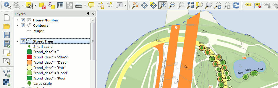
Geographic Imager is software for Adobe Photoshop that leverages the superior image editing capabilities of raster-based image editing software and transforms it into a powerful geospatial imagery editing tool. Work with satellite imagery, aerial photography, orthophotos, and DEMs in GeoTIFF and other major GIS image formats using Adobe Photoshop features such as transparencies, filters, and image adjustments while maintaining georeferencing and support for hundreds of coordinate systems and projections.

Geographic Imager 4.3 is immediately available and free of charge to all Geographic Imager Maintenance Program members and at US$319 for non-maintenance upgrades. New fixed licenses start at US$699. Geographic Imager Basic licenses start at US$199. Academic and volume license pricing are also available. Geographic Imager 4.3 is compatible with Adobe Photoshop CS5, CS5.1, CS6 and CC.

More about Avenza Systems Inc.

Avenza Systems Inc. is an award-winning, privately held corporation that provides cartographers and GIS professionals with powerful software tools for making better maps and for working with spatial imagery. In addition to software offerings for Mac, Windows and Apple mobile device users, Avenza offers value-added data sets, product training and consulting services.

Read More »

Leaflet 0.6.2 Released

A week ago the popular Leaflet version 0.6.2 was released, this comes about 5 months after version 0.5.

From the announcement: "0.6 highlights include nicer controls, lots of interaction usability improvements, many new API methods, events and options, ability to save layers as GeoJSON, much better test infrastructure and TONS of bugfixes that made Leaflet significantly more reliable. Checkout the huge detailed list of changes (120+ total!) in the changelog. The API reference was also updated to reflect all these changes. [...] On a related note, even GitHub itself is now using Leaflet for GeoJSON visualizations, along with Leaflet.markercluster & MapBox tiles!"

Another related entry is the Leaflet Plugin Authoring Guide.

Read More »

pycsw 1.6.0 released

The  pycsw  team  announces  the  release  of  pycsw  1.6.0.
The  1.6.0  release  brings  numerous  features,  enhancements  and  fixes  to  the  codebase,  including:
  *  Nabble  community  forum  now  available  via  OSGeo
  *  fix  broken  connection  in  pycsw.admin.optimize_db
  *  native  PostGIS  geometry  support
  *  new  community  section  on  website
  *  Web  Accessible  Folder  (WAF)  harvesting  support
  *  added  spatial  ranking  for  spatial  queries
  *  added  lxml  3  support
  *  fixes  for  new  OGC  CITE  tests
  *  added  support  for  SOS  2.0.0  harvesting
  *  added  support  for  SOS  1.0.0  harvesting
  *  added  database  specific  unit  tests
  *  added  support  for  nested  OGC  Filter  queries
  *  fixed  ISO  output/safeguarding  extent  elements
  *  fixed  parameterization  of  OGC  Filter  queries
  *  fixed  fulltext  search  to  dump  only  XML  element  values
  *  added  flexibility  to  pycsw.admin.setup_db  to  handle  use  cases  from  calling  applications,  like  specifying  extra  columns,  skipping  SFSQL  setup,  etc.
  *  added  support  for  ISO  19115-2  (gmi)  harvesting
  *  FGDC,  Atom,  and  DIF  are  now  core  supported  outputschema  formats,  and  do  not  need  to  be  explicitly  set  in  configuration
  *  added  CIDR  notation  support  for  CSW  transactions
  *  enhanced  link  support  when  harvesting  OWS  endpoints
  *  fix  tighten  Dublin  Core  writer  when  checking  on  dumping  XML
  *  fixed  harvesting  logic  for  unsupported  typenames
  *  fixed  GetRecords  typename  handling  to  _not_  behave  like  a  record  filter,  but  as  a  query  model
  *  harvesting  support  for  RDF  Dublin  Core
  *  fixed  Harvest  operation  parameter  checks  in  HTTP  GET  mode
  *  added  timeout  flag  to  pycsw-admin.py  post_xml  command
  *  continuous  integration  testing  (using  travis-ci)
  *  modular  Python  logging  capability
  *  paver  implementation  for  developer  tasks
The  full  list  of  enhancements  and  bug  fixes  is  available
This  release  also  moves  pycsw  forward  as  an  OSGeo  project  in  incubation.
pycsw  is  an  OGC  CSW  server  implementation  written  in  Python.
pycsw  fully  implements  the  OpenGIS  Catalogue  Service  Implementation  Specification  [Catalogue  Service  for  the  Web].  Initial  development  started  in   (more  formally  announced).  The  project  is  certified  OGC  Compliant,  and  is  an  OGC  Reference  Implementation.
pycsw  allows  for  the  publishing  and  discovery  of  geospatial  metadata.  Existing  repositories  of  geospatial  metadata  can  also  be  exposed  via  OGC:CSW  2.0.2,  providing  a  standards-based  metadata  and  catalogue  component  of  spatial  data  infrastructures.
pycsw  is  Open  Source,  released  under  an  MIT  license,  and  runs  on  all  major  platforms  (Windows,  Linux,  Mac  OS  X).
Source  and  binary  downloads:
----------------------------------------
Read More »