Here's parts of my talks notes of the 3D GeoInfo conference. Hope some elements are useful to some of you.
General notes
-
The whole conference was more of the research / academics type than the commercial providers one
-
"Glocal": global and local at the same time
-
General decline in conference attendance: different ways of networking and training, economic context
-
Next 3D GeoInfo will be in Istanbul in November
Talk notes
Opening talk
Opening talk, Jacynthe Pouliot
-
7th 3D GeoInfo conference
-
First time in North America
-
The 7th 3D GeoInfo was part of the Global Geospatial Conference (13th GSDI), which had about 700 participants, vs about 60 specifically for the 3D GeoInfo track
-
Thanks to the global conference, the exhibition hall was pretty big had lots of booths
-
The opening talk concluded with a speech by University Laval faculty dean
Modeling 3D topographic space against indoor navigation requirements
Brown, Germany
-
Requirements for indoor navigation for users
-
Use cases
-
Use cases such as routing to single or multiple destinations
-
Scenarios, considering access controls to locations (rooms)
-
Considering obstacles
-
Existing models: CityGML, IFC, 3d graphics formats... All have severe limitations for indoor navigation (none support navigation constraints)
-
Prohibited maneuver: physically possible, but prohibited, such as a turn on a one way street
-
Semantic and navigation constraints models for indoor navigation
-
Future work to be on extending existing model to remove current limitations for indoor navigation
Indoor localization using wifi fingerprinting for LBS applications
Sohn, York University
-
Augmented city, virtual and physical spaces become part of the same continuum, not two separate dimensions anymore
-
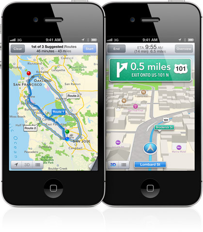
Using the Google Earth plugin for visualization
-
Linking real life webcams with live virtual world models, pretty interesting
-
Wifi fingerprinting requires multiple access points to enhance location accuracy
-
Using both wifi fingerprinting and wifi trilateration
-
Using Received Signal Strength (RSS)
-
Went Technical talk on location accuracies
-
Correctness rates of 80-90%
Enhancing visibility of labels in 3D navigation maps
Vaaraniemi, BMW
-
Visual presentation
-
Labels in 3D are often a problem when they're behind objects
-
Solutions includes transparency, wire framing
-
Goals: readability, mapping to element, spatial orientation
-
Draw behind and draw before doesn't work
-
Semi-transparent approaches
-
Five concepts: baseline, cut-aways (bad!), transparency aura (confusing too), glowing labels, glowing roads (best in my opinion)
-
They implemented prototypes and benchmarking, in OpenGL 3
-
During questions: how does it scale in mobile devices (instead of just cars)
-
During questions: labels at different scales, how does it deal with generalization
-
During questions: research regarding bending the faraway part of the map to better show labels
Semantic 3D modeling of multi-utility networks
Becker, Germany
Missed most of the talk.
-
Energy demands
-
Need: homogeneous representation, 3D topological and functional model, support for hierarchies and interdependencies
Integrating scale and space in 3d city models
Ledoux, Netherlands
-
5D: space plus time plus scale
-
Integrated into a 5D hypercube
-
Hypercube advantages: consistency, queries, data management
-
Generalizations processes
-
With the cube, there are no precomputed scales (18 for Google Maps and others), the cube is sliced at the requested scale each time
-
Slicing the space-scale cube non-horizontally in the scale
-
Interesting, automatically provides details near and low details away
-
Multiple dimensions slicing
-
Problem: gigantic storage capacity required
-
They'll try putting the cube in database
Generalization and viz of 3D building models in CityGML
Ullah Baig, Malaysia
-
Generalization: reduces data volume, complexity and unnecessary details
-
We're at semantic-based generalization for 3D building models... It evolved quite a lot in the past decade
-
Presented generalization techniques and algorithms
Modeling an application domain extension of CityGML in UML
Van Den Brink , Netherlands
-
Extended IMGeo to 3D
-
CityGML was too generic and IMxxx is rich on semantics, but 2D only
-
Data providers in Netherlands will have, by law, to use the IMGeo model
-
Mandatory, with optional elements
-
Application domain extension = ADE
-
They are at the conceptual stage
-
Next step is test the model
Keynote: Registration, detection and classification in point clouds in urban scenes
Ioannis Stavos, city university of new york
-
Lidar can use the differences in intensity of the return of the signal
-
Accuracy of 5mm
-
Point clustering with planar segmentation
-
Inherent problems at borders
-
Can infer lines and polygons from the point clusters
-
Presentation went technical
-
Range-intensity registration
-
Overlaying textures from 2D pictures on the 3D model
-
Doing Fourier transform to distinguish cars from trees within the lidar point cloud
-
Filling hidden parts (from object in front) using repeating patterns
-
Members of his team went to work for Google
-
Accuracy is about 85-90%
-
This was not really a keynote, the topic could have been in a common track... Nothing high level
Volumetric algorithms for single tree delineation towards A fully automated process for the generation of forests
Buecken, Germany
-
Visually impressive
-
Accuracy of over 90%
-
Excellent presentation despite the lack of notes
A service-based concept for camera control in 3D geovirtual environments
Klimke, Germany
-
So many challenges for 3D environments
-
Including heterogeneity, massive storage, updates, accuracy, etc...
-
Thick clients vs thin clients... Thin are required for mobile devices
-
Proposing a camera control service
-
One of the Goals: transfers part of the complexity and computation power required to the thick client instead of the thin client on mobile devices
Representing 3D topography in a DBMS with a star-based data structure
Ledoux
-
Constrained Delaunay tetrahedralisation (TEN)
-
Why TEN: Storage is is simplified, speed up spatial analysis, features are represented, robust implementation, spatial relations between unconnected features explicitly stored
-
Disadvantage of TEN: large database size
-
this talk is about compression of TEN data
-
Attempts were made in the past, but had serious limitations (not topological)
-
They're proposing a powerful 3D data structure
-
Easy to implement in a RDBMS
-
Pretty interesting
Can topological per-culling of faces improve rendering performance of city models in Google Earth?
Ellul, U.K.
-
Removing 3D polygon faces that are hidden from external view and merging those that overlap
-
Saved about 40% of space
-
Display time was about 2x faster
-
Might be significant for mobile devices and for reduced bandwidth situations
-
They're going to use WebGL instead of the Google Earth plugin
-
Google Earth is limited in terms of ingested file size
-
Solution is a tiled-approach... or switch to WebGL!
Revealing the benefits of 3D topology on under-specified geometries in geomorphology
Lowner, Germany
-
Went technical presentation
-
Lack of standard that fits the needs of geomorphology
-
Handling the fuzziness of geomorphological representations
Geometric-semantical consistency validation of CityGML models
Wagner, Germany
-
Pretty technical talk on validating CityGML models
-
Java application with GUI for the CityGML validation and create reports, called CityDoctor
Keynote - Philippe Cantin: building large cities for video games
-
Formerly from Ubisoft
-
CAD, GIS and video games worlds still have a lot to learn from each other
-
The practical components of moving in 3D video games
-
3D sound spheres and light sources have to be taken into account
-
The main constraint: memory required to load 3D elements... Constantly freeing and loading 3D objects
-
Required collaboration between stakeholders: developer, marketer,, designer, producer, etc
-
Concurrent edition of 3D environments... Like the Hero Engine (game industry)... Boeing did something similar instead of turn-based edition
-
City engine from the University of Zurich
-
Procedural building: instead of creating objects one by one, algorithms build objects such as building based on styles
-
Gaming industry also going in the cloud
Advancing DB4GeO
Kit.edu Breuning, Germany
-
Open source, at least the core
-
Object-oriented DB written in java
-
Seems to have a lot of advanced features
-
Imports exports CityGML data
-
Includes a web-based access using a RESTful architecture
-
Visualization with WebGL
-
Pretty impressive
Glob3 Mobile: an open source framework for designing virtual globes on iOS and Android mobile devices
Santana, Spain
-
It's a virtual globes framework for mobile devices
-
Oriented for iOS and Android, with a common API
-
iOS constraints, Android fragmentation... So nothing is perfect
-
They use a C++ code converter to create java code for their Glob3 engine
-
WebGL scheme
-
Embeddable 3D globe
-
Tiled layer and WMS compliant
-
Showed a demo and seems to work great!
-
Next steps...
-
Html5 and WebGL... Currently runs very well
-
Add 3D models and geometries to the globe
-
Glob3m on glob3 & Ami
Reconstruction of rectilinear building facets
Utrecht university, Lankveld
-
Point-based urban reconstruction
-
Technical presentation
-
Making polygons out of a cloud of points in 2D
-
Seems pretty effective
Reconstruction, storage and application of 2.7D models
Gorte, delft university
-
TIN with vertical walls... 2.7D is between 2.5D and 3D
-
Context is urban hydrology
-
2.5D DEM with 3D buildings
-
Using the star model
-
Storing TINs in a single table
-
Removing points that are coplanar, then removing colinear middle points
A 3D GIS implementation for realizing 3D network analysis and routing simulation for evacuation purposes
Karas, Turkey
-
Evacuation scenarios
-
Using Oracle Spatial and a java-based 3D GIS, JOGL bindings for OpenGL
-
Supports CityGML, they used for visualization
-
Network analysis all done within Oracle Spatial
-
They built a routing instructions engine, instructions for people getting evacuated
3D Geospatial modeling and visualization for marine environment: the Canadian arctic
Sahlin, Canada
-
The biosphere is essential composed of the marine ecosystem, the land-based is of a small volume in comparison
-
Study in the Beaufort Sea area, near the Mackenzie river delta
-
560km wide delta, quickly goes to 1km depth
-
Looking at snapshots in time, the temporal component is usually essential to consider in oceanography
-
He found that the best tool for him was GoCAD
-
Table comparing the various options
-
Continuous 3D space not well integrated into 3D GIS modeling tools
-
3D GIS still have a lot of lacks in terms of 3D spatial analysis comparing to the 2D analysis features
-
Kringing interpolation worked best for them
-
They tried EnterVol for ArcGIS
Keynote: Richard Mongeau - measurements and 3D representations of the territory by land surveyors of the City of Montreal
City of Montreal, Geomatics Division
-
Talk in French but with slides in English... pretty strange since most of the audience can't understand French
-
Land surveyors act... Law that specifies reserved acts for land surveyors
-
90 colleagues at their Geomatics Division
-
4120 geodetic points on the Montreal island, passive network
-
Active network of about 12 geodetic locations
-
3D city model built for the 'Montreal' project done almost a decade ago
-
They significantly update it since then
-
With Bentley, LOD-1 and LOD-2, data is piped directly into CityGML standard
-
Data sometimes comes from photogrammetry
-
They use RhinoTerrain software
-
They also use terrestrial lidar
-
Conveying positional accuracy metadata is crucial, users must know what they have in their hands
-
Finding the sources of errors and data integration issues
-
Lasergrammetry with target for calibration and validation
-
Data customers sometimes ask for centimeter accuracy while they don't really need such accuracy
-
Legal cadastre in 3D, underground, such as the new planetarium project
-
They use Bentley software for sewer networks and water distribution networks
-
They use color coding for representing the various categories of accuracy
-
The level of detail they have for the whole city is impressive
-
They develop a lot of tools with Bentley, which certainly is happy to work with such a customer
-
They also do some dynamic data acquisition, such as mobile lidar
-
They have an automated tree inventory
-
They use a lot of various software, Bentley, Oracle Spatial, FME, ArcGIS, 3D PDF, and even Google Earth
-
They have technical standards and even a 3D ethics charter!
-
Apparently, not that many municipalities have so integrated 3D systems
-
Excellent and funny talk, but since it was in French, he lost a lot of attendees
A 3 steps Procedure for enriching augmented reality games with CityGML 3D semantic modeling
Zamyadi, Canada
-
Energy Wars mobile game
-
Location-based scenario and uses augmented reality
-
This was a Geiode-funded project
-
Absence of a methodology for AR-oriented 3D data modeling
-
Their 3 steps: reverse engineering, enriching with 3D features, mapping to CityGML
-
One of the main reason for choosing CityGML, is for interoperability
-
Using a CityGML ADE (application domain extension)
-
This is mostly at the UML stage, the impact on the modeling process has not been tested yet
Implementation of a National 3D standard: Netherlands
Zlatanova, Netherlands
-
Standard named IMGeo, information model geography
-
Integration of CityGML and IMGeo
-
IMGeo 2.0 established in
-
OGC 3DIM adopted their approach
-
Port of Rotterdam uses in some cases physical models (!) to visualize underground 3D
-
Thanks to these efforts, stakeholders can now have "focused 3D ambitions"
Exploring cultural heritage resources in a 3D collaborative environment
Hidalgo, Spain
-
For presentation, analysis and exploration
-
Openwonderland, collaborative virtual world
-
They used "improvise" build-browse-behold java software to build and browse visualizations interactively
-
Mostly at the conceptual stage - Interface not tested by users yet
-
Speaker not so comfortable in English
OpenBuildingModels - Towards a platform for crowdsourcing virtual 3D cities
Uden, university of Heidelberg
-
OpenStreetMap and the Google 3D Warehouse
-
OSM-3D: 3D globe based on OSM and SRTM-DEM data
-
Prerequisites for 3D VGI have never been this good: Kinect, Photosynth... Low cost hardware and service-based photogrammetry
-
Current issues:
-
No 3D support in OSM's simple data model
-
Not enough tools for users to contribute various 3D information in different LoDs
-
Vision for OpenBuildingModels
-
Free to use repository, with links to OSM
-
There is already multiple 3D models communities out there
-
3D warehouse, opensceneryx, free3dmodels, shapeways, archive3d
-
Openbuildingmodels is a prototype at the moment
-
Using PostGIS, GeoServer, OpenLayers
-
Challenges: model georeference, and various other minor elements
-
Excellent presentation
-
Next big thing is 3D VGI
Mobile modeling for crowdsourcing building interior models
Rosser, uk
-
For exterior, Google Building Maker, for interior Trimble SketchUp (formerly Google SketchUp)
-
OpenRoomMap, extending OSM for indoor mapping - indoorosm
-
User control on sensitive data
-
Smartphones for data capture, but georeferencing remains an issue (no GPS indoor)
-
They built a prototype app for Android's galaxy nexus
-
Many challenges in the data capture, be to do many assumptions
Read More »