Tag Archives: Google Earth

Batch Geonews: Stick to WMS 1.1.1, ESA Free RS Book, ArcGIS Online Major Update, Christmas, and much more

This is our last batch-mode edition of the year - happy holiday break to everyone!

From the open source / data front:

  • MapBox share an interesting entry named The Trouble with Geoportals: "Heavy interface-driven sites based on predetermined data acquisition processes are a key part of a local, state, and national spatial and open data infrastructures, but they do not make open data open and accessible to all."
  • Here's a nice demo of OpenLayers 3, read the associated discussion
  • Here's news of the QGIS Globe and PostGIS 3D with a video demo
  • Here's an entry on how the LGPL license of geospatial software is completely destroying iOS adoption of open source geospatial software
  • Here's about the version 1.8.0 release of Libspatialindex (which switches from LGPL to MIT) 
  • And Jeff McKenna is the new OSGeo president
  • Here's an article on Vizzuality, the makers of CartoDB

From the Esri front:

  • Here's a summary of Whats New in ArcGIS Online (December): "This is major update, with new capabilities for authoring web maps, publishing hosted services, sharing, and configuring ArcGIS Online organizations."
  • DigitalGlobe Imagery for the United States and Western Europe added to the Esri's World Imagery map
  • If you're eager to know, here's What’s coming in the next update of the ArcGIS SDK for Android?

From the Google front:

  • Obligatory, Christmas Trees in Google Earth and Street View
  • Interesting, Using Google Earth to teach math
  • Google shared tips for getting the most from Google Maps on iPhone
  • Apparently, the iOS version of the Google Maps app might violate EU privacy laws
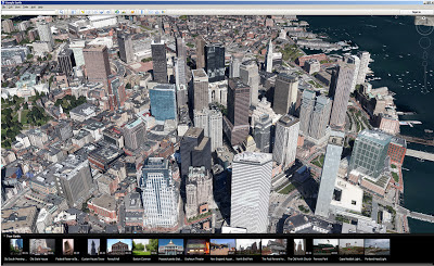
  • Here's what Google Earth looks like on the Nexus 10
  • Here's the Google entry on the Count down to Christmas Eve with Google Santa Tracker
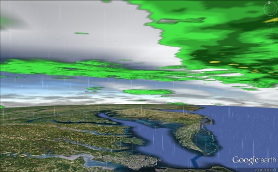
  • It's the end of the world right? Predicting volcanic ash with Google Earth
  • That's not a reason for not providing New Google Imagery - December 17

In the remote sensing category:

  • If you have an iOS device, don't miss ESA's 'Earth from Space: the Living Beauty' free book: "The digital publication has over 100 pages with interactive maps, stunning image galleries and animations that encourage you to discover the various Earth processes. "
  • Name change, Copernicus is the new name for European Earth Observation Programme
  • Here's a discussion on How to build a microsatellite

In the miscellaneous category:

  • Know the WMS standard? Here's a pertinent entry named Don't "upgrade" to WMS 1.3.0 unless you really have to, stick to 1.1.1
  • Here's a pertinent entry on GIS user interfaces and how bad they are
  • Here's the Directions Mag summary of A Day at Nokia’s U.S. Headquarters
  • While they can't do it anymore with a GPS device, the U.S. government can use location data from cell towers in order to track suspects without a warrant

In the maps category:

  • Here's an Interactive map of the U.S. Nuclear Weapons Complex
Read More »

Uber Weather

Hi, please check out my new desktop map application:

 
I am looking for partners to help make it better, and translate Uber Weather into as many languages as possible. 
 
Check out the 14,000 ski lifts and right click for 3D! 
Read More »

Google Geonews: Ingress LBS+Augmented Reality Game, Ski Resorts, Mining Atlas, and more

I've been overly busy lately, please allow the delay. Here's the recent Google-related geonews.

From official sources:

  • Google is ready for winter, Mapping the Canadian Arctic and global ski resorts
  • Here's a story about A 5,000-mile walk across Asia, guided by Google Maps
  • For the U.S., here's a map related to Zagat’s America's Top Restaurants revealed
  • Here's the official entry on the imagery update two weeks ago

From other sources:

  • The GEB invites us to explore over 10,000 mines with Mining Atlas in Google Earth
  • It also informs us how to create amazing Google Earth tours with TourMaker
  • And in the same direction, a great 3D driving simulator that uses the Google Earth plug-in
  • APB made me aware of Google's new location-based + Augmented Reality game named Ingress, see its introductory video below. Here's how APB summarizes it:
    • There are two teams: “The Enlightened,” who embrace the power, or “The Resistance,” who fight the power.
    • You get "energy" by visiting real wold paths (like a human PacMan).
    • You go on missions to portals which are associated with real places like libraries, public art and onter public places.
    • There's a tie in to real world vendors and products (Hint Water, Zipcar, Jamba Juice and Chrome apparel and messenger bags).
Read More »

Google Earth 7 Released, Google Maps’ New Natural Geography, Post-Sandy Imagery, and Other Google Geonews

A new major version of Google Earth doesn't happen everyday, explore the world with tour guide and 3D imagery in Google Earth 7.

From the announcement: "A few months ago, we announced Google Earth for mobile, which offered new ways to see cities in 3D and a new tour guide feature to help you discover places of interest on the go. Starting today, you can get both of those features on a bigger screen that makes it even easier to explore by downloading Google Earth 7 on your desktop. Check out the comprehensive and accurate tours of more than 11,000 popular sites around the world, including our growing list of cities where new 3D imagery is available."

Other recent Google geonews:

  • I'm very happy that we get a better view of natural geography with Google Maps, follow the link for before/after images, but in short, Google Maps now shows us natural geography like forested and mountainous areas when zoomed out - much much nicer. And here's some more information for developers
  • Google also released the first batch of post-Sandy imagery to Google Earth (image below)
  • You can now add your Photo Sphere images to Google Maps with Android 4.2
  • Here's a script to View all of your Google Contacts in Google Earth
  • An entirely other topic, Google Earth reveals the secret of Angkor Wat's construction
  • Much less funny, Imagery of sectarian destruction In Burma’s Rakhine state now on Google Earth
  • APB tells us that Google and Friends Launch Privacy-focused Crowdsourced Image Blurring Service in Germany
  • And there's fresh imagery for everyone

Read More »

Google Geonews: Biggest Street View Update, New GM Tracks API and GM Geolocation API, GM for iOS Alpha, and more

Here's the recent Google-related geonews.

From official sources:

  • Google made their biggest Street View update ever: "[...] doubling our number of special collections and updating over 250,000 miles of roads around the world. We’re increasing Street View coverage in Macau, Singapore, Sweden, the U.S., Thailand, Taiwan, Italy, Great Britain, Denmark, Norway and Canada. And we’re launching special collections in South Africa, Japan, Spain, France, Brazil and Mexico, among others."
  • There's expanded coverage of building footprints in Google Maps: "25 million new building footprints that have been added to Google Maps"
  • The Dev blog introduces the Google Maps Tracks API and the Google Maps Geolocation API:
    • Google Maps Tracks API allows an organization to build applications that can store, display and analyze GPS data on a map.  The API is built on top of Google’s reliable cloud infrastructure and offers specialized features such as geo-fencing.
    • Google Maps Geolocation API enables an application or device to determine its own location without the use of GPS by looking up the locations of nearby wifi access points and cell towers. By limiting GPS usage, a device can save battery life and work indoors or in remote areas.
  • Here's Street View inside Google's data centers

From other sources:

  • Here's early screenshots of Google Maps for iOS in alpha testing
  • The GEB tells about weather in Google Earth
  • And of course, there was the expected satellite imagery update

Read More »

Google Geonews: Google and Apple Maps, Street View Goes Underwater, Many Data Updates, and more

Please allow the recent silence, busy week, I should be able to catchup next one. Here's the recent Google-related geonews.

Regarding Google and Apple Maps:

  • MacRumors claimed that Apple's Split with Google Over iOS Maps Driven by Turn-by-Turn Navigation Dispute, that Google's Work Toward Standalone iOS Maps App Complicated by Integration with Google Earth and apparently, Apple Reportedly Had Over a Year Left on Maps Contract with Google
  • Slashdot discussed Apple Reportedly Luring Ex-Google Mappers With Jobs

From official sources:

  • Google Maps now offers underwater imagery, a topic discussed by Slashdot in Google Captures 'Street View' of Underwater Habitats
  • Street View reaches other new places, introducing Imagery of Chile and Croatia on Google Maps, and Andorra too
  • Google Maps for Android has been updated, and you get all your Google Maps searches in one place
  • Live Road Traffic Launches in 3 New Countries, in three new cities: Jeddah, Saudi Arabia; Kuwait City, Kuwait and Guayaquil, Ecuador
  • Your can now explore the great indoors of France with Google Maps for Android

From other sources:

  • Slashdot discussed California Legalizes Self Driving Cars, and to my knowledge, Google is leading the way the car's future
  • Here's Geoception, a new Google Earth-based game: "In a nutshell, you command and control a fleet of combat drones to provide local and regional security, eventually taking over the whole world."
  • The GEB also offers an entry named Cambodians fighting malaria with SMS and Google Earth
  • And yes, there was another imagery update
Read More »

Google Geonews: Biking Directions on Android, Map Maker and Street View Updates, and more

Slowly starting to catch up mid-August geonews, here's the associated recent Google ones.

From official sources:

  • Bikers rejoice, biking navigation in 12 countries in Google Maps for Android: "That’s why today we’re bringing mobile biking directions and navigation to the 10 countries [...]. Plus, we’re adding turn-by-turn, voice-guided biking navigation to Google Maps Navigation (beta) in every country with biking directions."
  • There's Map Maker updates for Lesotho, Oman and Trinidad & Tobago and Detroit, Michigan
  • Street View:
    • Google Maps and Street View are going to Canada's far north
    • Street View is also much improved in Brazil and prehispanic Mexican cities
    • You can See Rebuilding in New Orleans Through Updated Street View Imagery
  • As a public transport daily user, I'm happy that Google Maps now has schedules for more than one million public transit stops worldwide
  • We did mention geo-wiki last February, and now Google shares an entry named Validating Land Cover Datasets with Geo-Wiki, using a blend of Google tools and open source ones (e.g. MapServer, PostGIS)

From other sources:

  • The GEB links to 'A New Life' new country generator in Google Earth for use in education and fun
  • APB mentioned Google acquired 7 deCarta LBS patents
  • There's still much left to discover on this planet, New Egyptian pyramids found using Google Earth?
  • There's Mars' Curiosity rover imagery in Google Mars now
Read More »

Google Geonews: Google Earth for iOS 7 Released, Europe Maps Updated, More Landsat Imagery, London Olympics, and more

Here's the recent Google-related geonews.

From official sources:

  • My iPad 2 invited me to update iOS's Google Earth to version 7: "With today’s release of Google Earth for iOS you can literally fly through breathtaking 3D city landscapes and images and follow virtual tours of places you’ve never been [...] The growing list of 3D cities include Boulder, Boston, Charlotte, Lawrence (Kan.), Long Beach (Ca.), Los Angeles, Portland (Ore.), San Diego, Santa Cruz, Tampa, Tucson, and the San Francisco Bay Area (including the Peninsula and East Bay) as well as Rome, Italy. [...] Also new in this release is a “tour guide” to show you interesting places to explore." This topic is discussed at Slashdot in a story named Google Outs 3D Maps For iOS Ahead of Apple.
  • Google also announced more detailed maps in parts of Europe, Africa and Asia: "And today, we’re launching updated maps of Croatia, Czech Republic, Greece, Ireland, Italy, Lesotho, Macau, Portugal, San Marino, Singapore and Vatican City to do just that."
  • As part of the 40th anniversary  of the Landsat satellite program, Google now includes more Landsat imagery: "We’re working with the USGS and Carnegie Mellon University, to make parts of this enormous collection of imagery available to the public in timelapse videos of the Earth's surface. With them you can travel through time, to see the transformation of our planet."
  • There's new additional panoramic imagery of historic Antarctic locations
  • Google also shared an entry named Maps for good: Google Earth Outreach Developer Grants

From other sources:

  • The GEB shares an entry on exploring the London Olympics in Google Earth
  • The same source mentions 'Google Earth Studio', a tool for the media, in an entry on Google Earth's relevance for news
  • The GEB also shares an entry on exploring fake deserts of the world in Google Earth
  • Slashdot ran a discussion named Ox Bow Lake Formation, As Seen By the Google Earth Time Machine
  • Tens of sources mentioned that Marissa Mayer, Google's former vice president of Local, Maps & Location Services was appointed CEO of Yahoo
Read More »

Google Geonews: My Tracks 2.0, Biking Directions in Europe, Indoor Maps in Museums and in the UK, 11,000 Tours, and more

Here's the recent Google-related geonews. From official sources:

  • Google announced the release of My Track 2.0, the open source app on Android to generate GPS/GNSS tracks and share them in Google Maps and Google Earth
  • Biking directions in Google Maps expands to several countries in Europe and Australia, a topic also discussed on Slashdot
  • In the latest Google Earth for Android (and upcoming for iOS), they included a new tour guide feature for visual trips using the great new 3D imagery they are adding. There is 11,000 tours available covering 110 countries!
  • California's National Parks are now available in Street View
  • Walking directions made its way in Google Maps for Africa
  • In the latest Google Maps for Android, you now get indoor maps of 20 popular museums, added to the 10,000 other indoor maps they already provided
  • Related, there's an entry on going indoors at locations across the United Kingdom
  • There is new 45° imagery available for 31 cities including 26 cities in the U.S. and 5 international locations
  • Google also offers an entry on Map Makerpedia, their community tool for Google Map Maker (but you already know I prefer OpenStreetMap, for openness reasons)
Read More »

Google Geonews: Google Dev Glasses Available, Google Earth for Android 7 Released with 3D Cities, and more

Here's recent Google-related geonews, with some pretty interesting.

  • While there's a new uninformative official entry on Project Glass, their augmented reality glasses we mentioned in April, Slashdot provides more information in this entry named More Details On Google Glass, including: "As we mentioned earlier, the developers at I/O have the option to buy the 'Explorer Edition' of Google Glass for $1,500. In addition to the (functional, but unfinished) device itself, they also get access to Google's engineers and to keep up with the devices development. Worry not: when the consumer version of the device is finalized, it will be cheaper, but of course they aren't ready to talk about actual prices yet. As for availability: "Less than a year after we get these Explorer Editions out.""

From official sources:

  • A new Google Earth for Android version is out, with new 3D cities imagery, yes, that's the new great city imagery similar to what Apple Maps will provide with iOS 6, and Google will soon provide a new  iOS version of Google Earth too. The other major feature is the 'Tour guide': "We’ve put together short tours of thousands of famous places and historical sites across the globe so it’s easier than ever to discover amazing places." Here's which cities have the new 3D imagery: "Boulder, Boston, Charlotte, Lawrence, Los Angeles, Long Beach, Portland, San Antonio, San Diego, San Francisco, Santa Cruz and Tampa in the United States, along with Rome, Italy."
  • The Dev blog announced that Public transit routing and layer now are now available in the Google Maps API
  • It was announced and it's now reality, you can now Go offline with Google Maps for Android
  • And because we need to seriously take care of our home, Planet Earth, Google shares Geo in Rio: Cool Tools for a Warming Planet, and another related official entry is about Crowdsourcing Forest Monitoring
  • The official Dev blog shares an entry on symbols and heatmaps for the Google Maps API
Read More »