April 11
Portland, OR, USA
Regular Session and Academic Track proposals due
A reminder to all FOSS4G attendees - the proposal submission deadline for both the Academic Track and Regular Sessions is next Tuesday, April 15th. For the Regular Sessions, we strongly recommend reviewing our advice for successful proposals before submitting.
The community voting on the Regular Sessions will directly follow the deadline, April 18th to 28th.
Travel Grant Announcement
We realize that traveling to and attending a conference can be expensive, and that not everyone who uses or develops open source software has provided funding to pay their way or the means to pay for it themselves. To make sure that as many deserving people as possible can attend FOSS4G, we're creating a travel grant program with funds to cover registration and travel costs. Watch for details coming soon.
One additional reminder: Early Bird Registration is open!
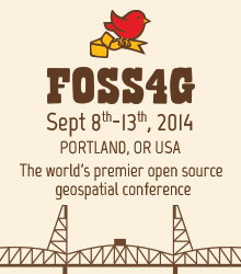
Important Conference Dates
See the full calendar for more details.
-
April 15th: Academic Paper/Presentation Proposals Due
-
June 15th: Early bird registration ends
-
Sept 8th-9th: Workshops
-
Sept 10th-12th: Main Conference
-
Sept 13th: Code Sprint
About FOSS4G
The annual FOSS4G conference is the largest global gathering focused on open source geospatial software. FOSS4G brings together developers, users, decision-makers and observers from a broad spectrum of organizations and fields of operation. Through six days of workshops, presentations, discussions, and cooperation, FOSS4G participants create effective and relevant geospatial products, standards, and protocols.
FOSS4G has been held all over the world and draws attendees from over 40 countries. Nottingham, England hosted the conference in. In, Portland, Oregon, USA will host FOSS4G’s tenth year.
About OSGeo
The Open Source Geospatial Foundation (OSGeo) was founded in to support and build the highest-quality open source geospatial software. The foundation's goal is to encourage the use and collaborative development of community-led projects, data development and education. Many projects live under the OSGeo umbrella, including FOSS4G.
About PDX-OSGeo - Portland Area and Oregon OSGeo Chapter
The PDX-OSGeo chapter of OSGeo has been meeting, discussing and promoting the use of open source geospatial technology. Chapter members often organize or present on open source software at regional geospatial conferences. PDX is the airport code and like the PDX airport, the group has a wide catchment area.
Sponsors
Silver Level Sponsors


Bronze Level Sponsors


Supporters


Media Partners
These leading geospatial media organizations have partnered with FOSS4G to keep their readers informed.